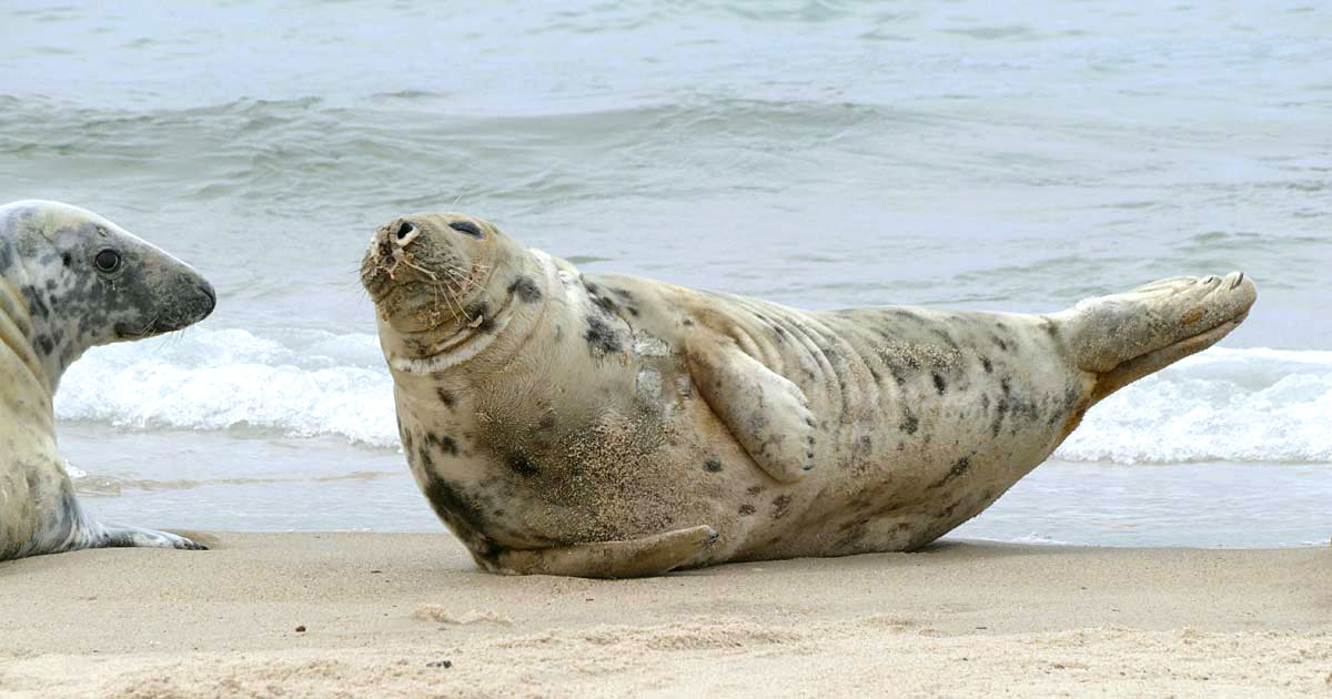
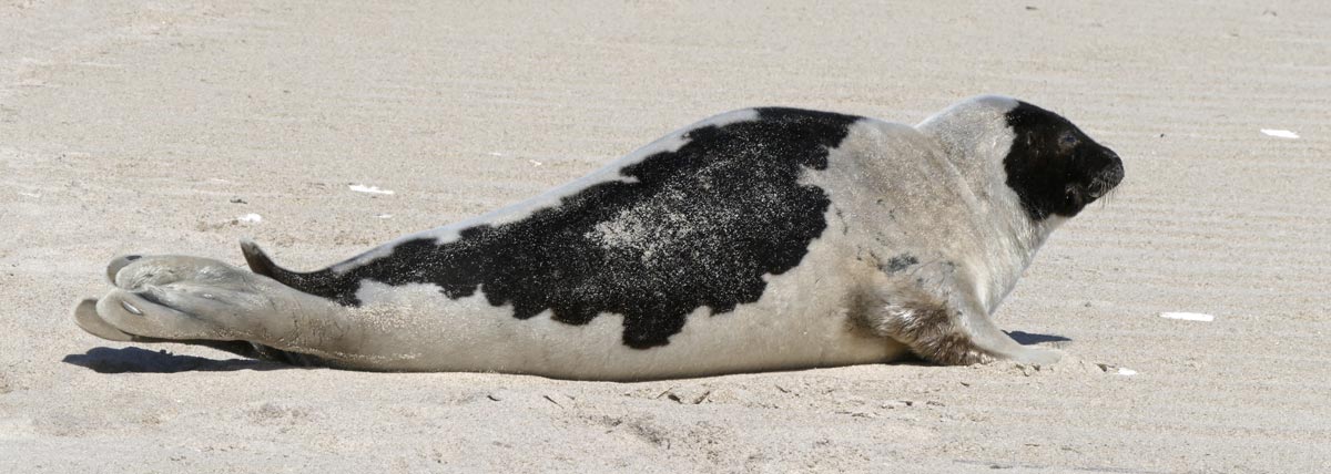
Image above: A Grey Seal resting in the typical “banana” position.
Since I was already on Sable Island when the national parks were closed, I was able to stay and continue work on some of the Sable Island Institute’s projects. Parks Canada has maintained minimum staffing here to support basic station operations. Although there are many concerns about friends and family, the island seems distant from the COVID-19 crisis, lockdown, physical distancing, and social isolation.
For the island itself, it has been a mostly normal spring – a flush of green is creeping over the landscape as new growth of grasses, beach pea and other plants emerges from the damp sand. Ipswich Sparrows are nesting, Grey Seals are moulting, and Sable Island horses are foaling. We’ve had some big storms with high winds and heavy rainfall, as well as days of blue skies, mild temperatures and gentle breezes. Some interesting wayward birds have turned up (e.g., Glossy Ibis and Purple Gallinule), and it is always a delight to see some of the regulars passing through – Catbird, Hermit Thrush, Fox and Song Sparrows, and Junco.
The following is a collection of notes about Sable Island during late March to mid-April.
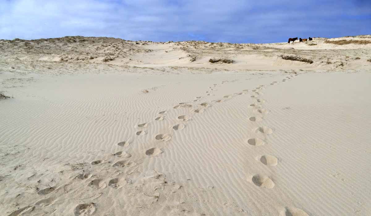
Sable Island Horses in Early Spring
 A family band of five horses resting in the sun on a south-facing slope. The slope provided shelter from the northeasterly wind (peaking at 21 knots). The day’s maximum temperature was 3.9°C.
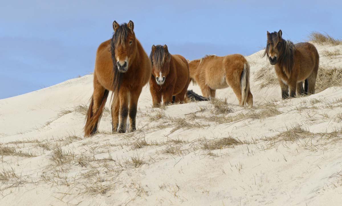
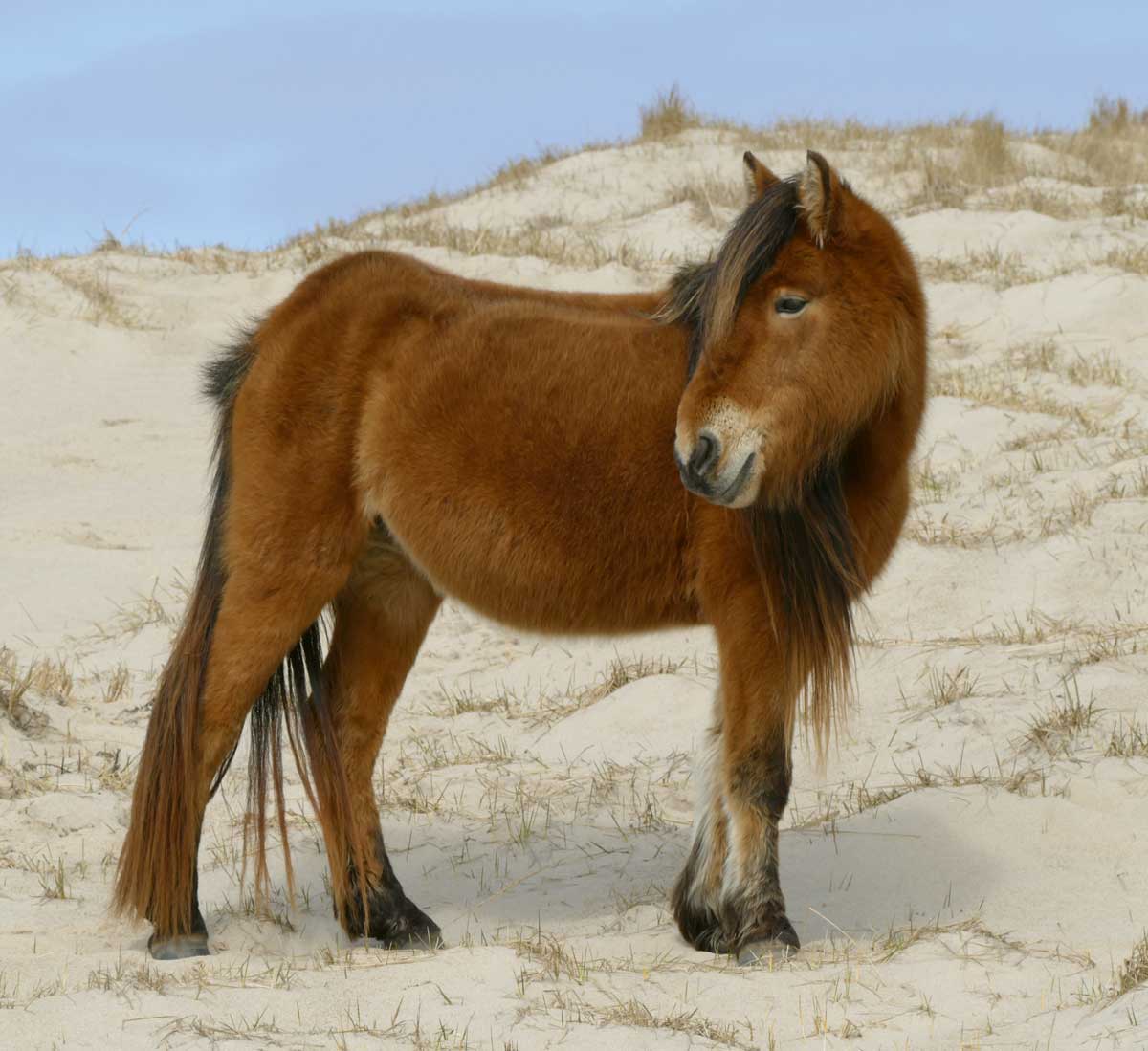
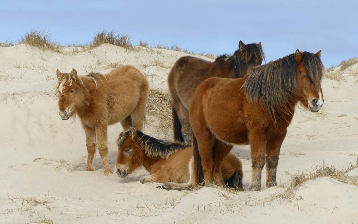 All the horses – adults and young – still have their thick winter coats. No signs of shedding yet. When they begin to shed, the adult males are generally the first to lose the long coat hair. The horse with the white nose stripe is the band stallion in this group.
 As she wanders away from the band, heading toward Mummichog Pond for a drink, the mare pauses to look back at the group… “Anyone coming?”
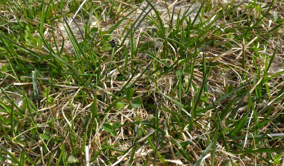
 Horses grazing as the sun rises. The landscape looks bleak, but among the dead and flattened grasses and twigs, green leaves of marram, poa, strawberry, yarrow and wild rose are beginning to show.
 Strawberry, as if its leaves were taking a deep breath of the sweet spring air.
 In sheltered patches, early spring growth of clover and grasses provide a flavourful snack for foraging horses.
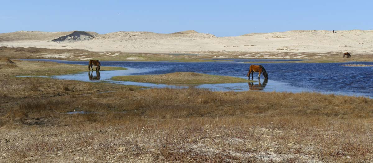 Horses drinking and grazing along the south side of Mummichog Pond. This large, but shallow, freshwater pond is just west of West Light.
The pond is named for a fish species that is abundant in this and nearby ponds. The mummichog (Fundulus heteroclitus) is a small killifish found along the Atlantic coast of North America. It is a hardy species able to tolerate variable salinity and temperature fluctuations. Beyond Sable Island this fish occurs in a range of habitats including estuaries and salt marshes.

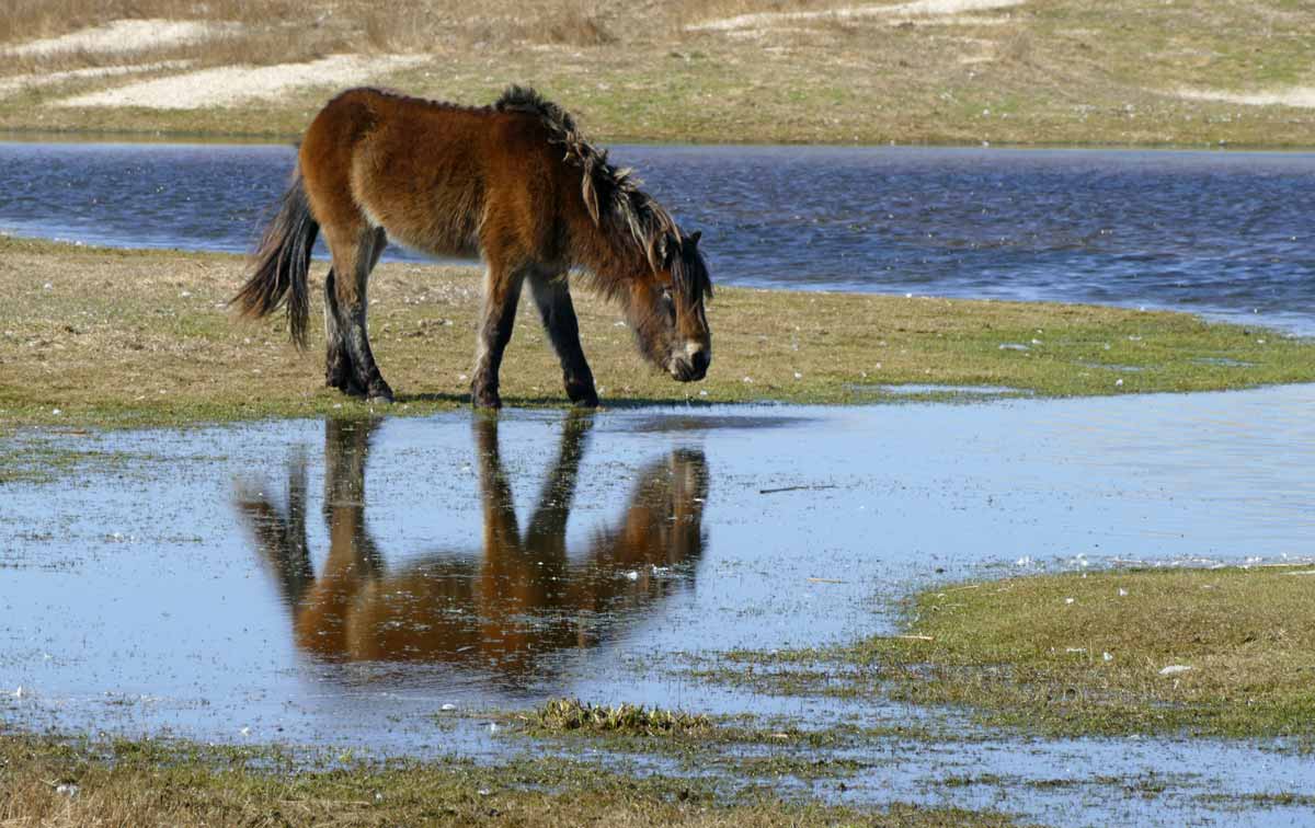 In spring the island’s freshwater ponds are usually brimming with water. Horses drink at the pond and also graze the wet pondedge vegetation.
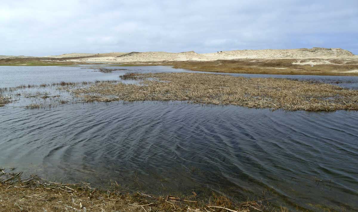 Another pond, just southeast of Mummichog, also at high water level. The family band in the first photos can be seen in this image – in the far distance, as a group of small dark spots at the top of the south-facing slope.
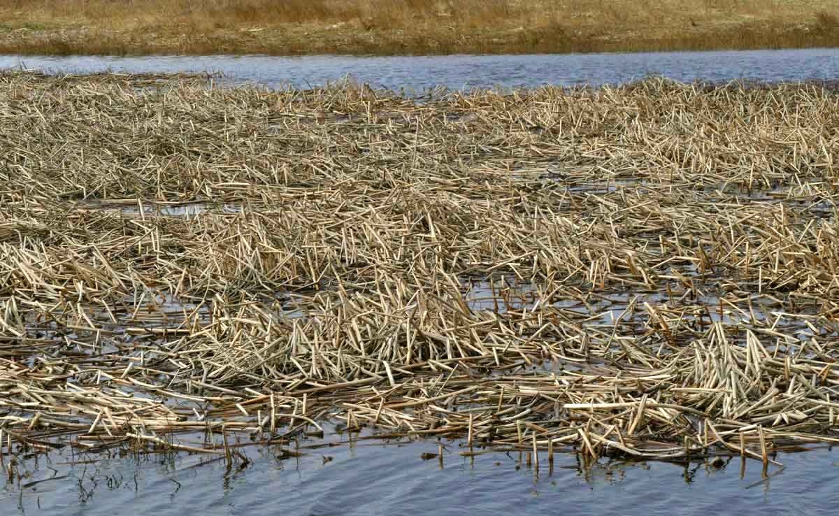 As new growth develops from the tangle of last year’s stems of bulrush, the stand will become a rich foraging site for nesting and visiting bird species.
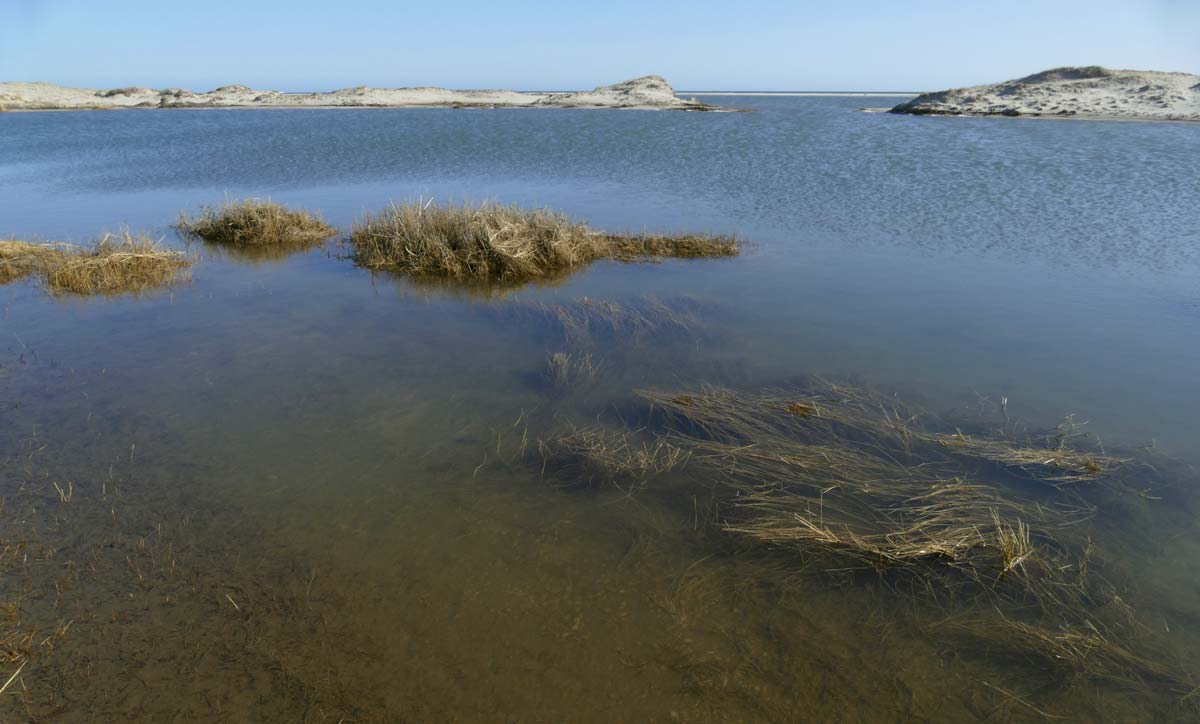 Lily Pond North was named for the yellow pond lilies (Variegated Pond Lily, Nuphar lutea ssp. variegata) that used to cover about half of the pond’s surface. During the past five years, erosion of the dune line left the pond increasingly exposed to saltwater flooding from the south beach. There are no longer any water lilies in Lily Pond North.
And Lily Pond South is long gone – also lost to erosion and saltwater incursion.
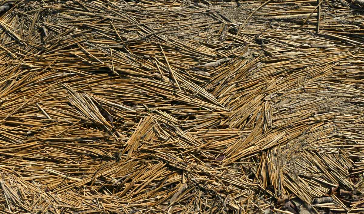 Juncus is abundant in the terrestrial plant community surrounding Lily Pond North. When saltwater washes in during winter storms, dead stems of juncus are swept into driftlines along the edge of the pond.
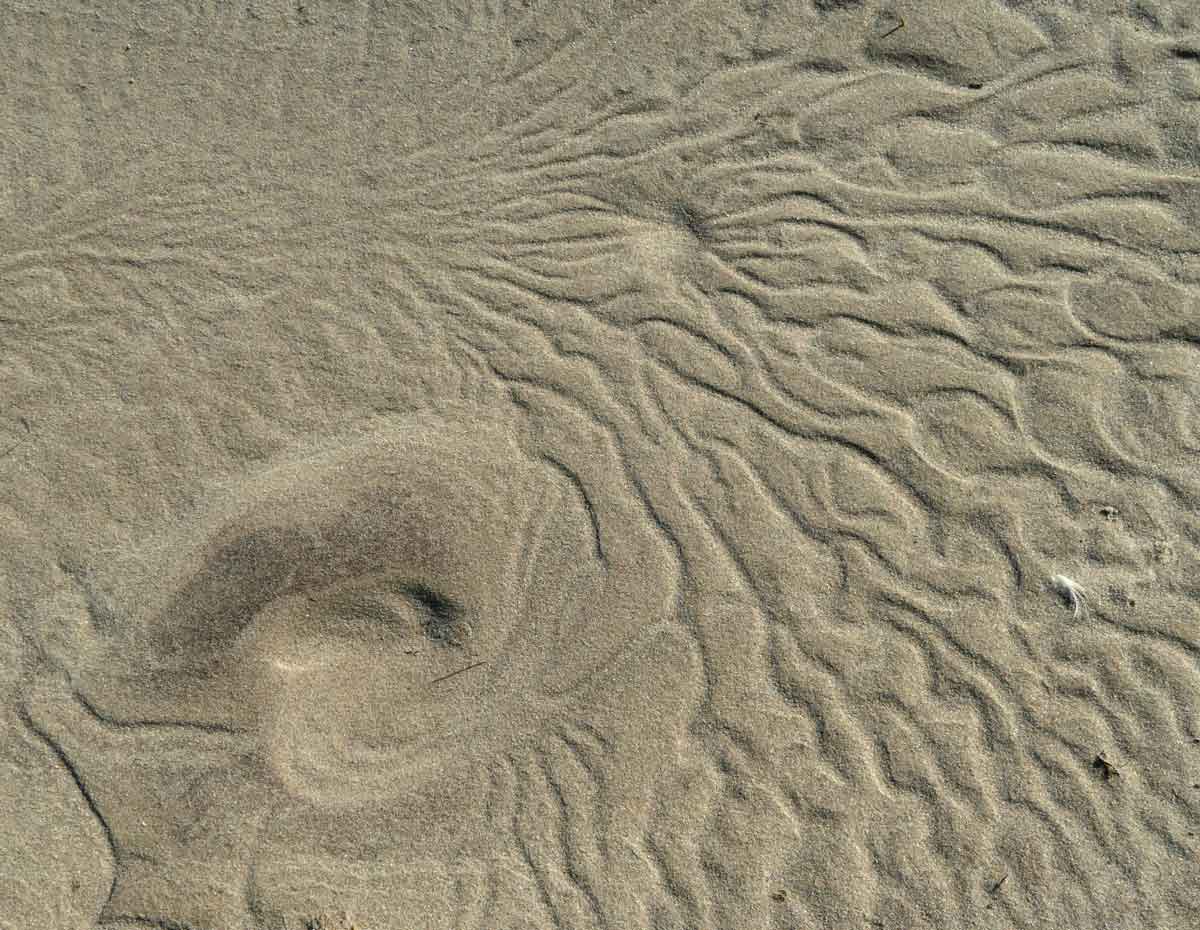 One of many sand patterns formed along the shore of Lily Pond North as saltwater flooding recedes. As Jordan Eamer might suggest, this could look like a satellite image of a vast area of landscape.
A Delayed Observation of a Duck of Particular Interest
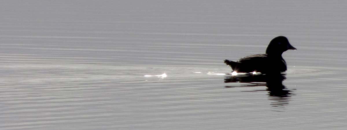 Gina Little took this photo in late December 2016 – a backlit duck paddling peacefully across the calm, silvery water of Pinetree Pond West. It was a mild day (maximum 2.5°C) with a very light breeze.
In early April, while preparing one of Gina’s earlier PhotoBlogs (October 2016 – January 2017) for the website, I noticed this image in her photo selection.
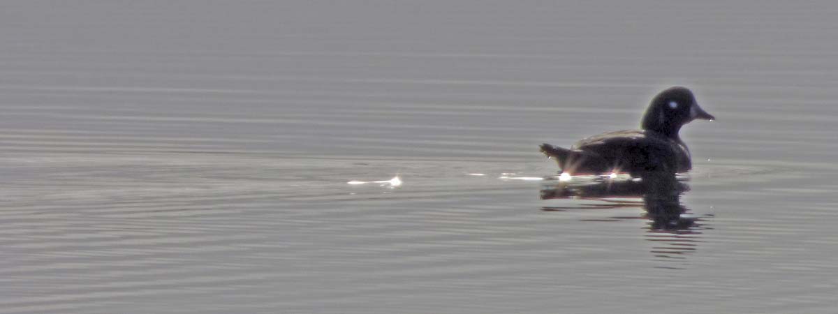 A little lightening of the shadow revealed a Harlequin Duck.
 As it turned out, Gina had a few other shots of the same duck.
Although when enlarged all the photos are a little soft, together they provide a glimpse of characteristics suggesting that this Harlequin is a first winter male. So, although this bird occurred almost four years ago, ‘discovering’ the duck among Gina’s photos was cause for some excitement.
A previous sighting of this species at Sable Island is reported in Ian McLaren’s Birds of Sable Island, 1981: “Five frequented the surf zone off the north beach near West Light between 28 September and 3 October 1977 (AR).” AR is Alban Richard, the station handyman for the Meteorological Service of Canada in the 1970s. During 1974-1979, Alban sent regular bird lists and summaries to Ian McLaren.
A Cranberry Community in a Dune Slack
 One of Sable’s dune slacks, carpeted with cranberry, juncus and bayberry.
In mid-summer, the brilliantly-coloured magenta-pink flowers of Calopogon orchids are abundant here, hundreds of them. In winter and spring, low elevation areas such as dune slacks are, like the ponds, flooded with freshwater. When they are covered with water, horse paths through the slack look like small brooks.
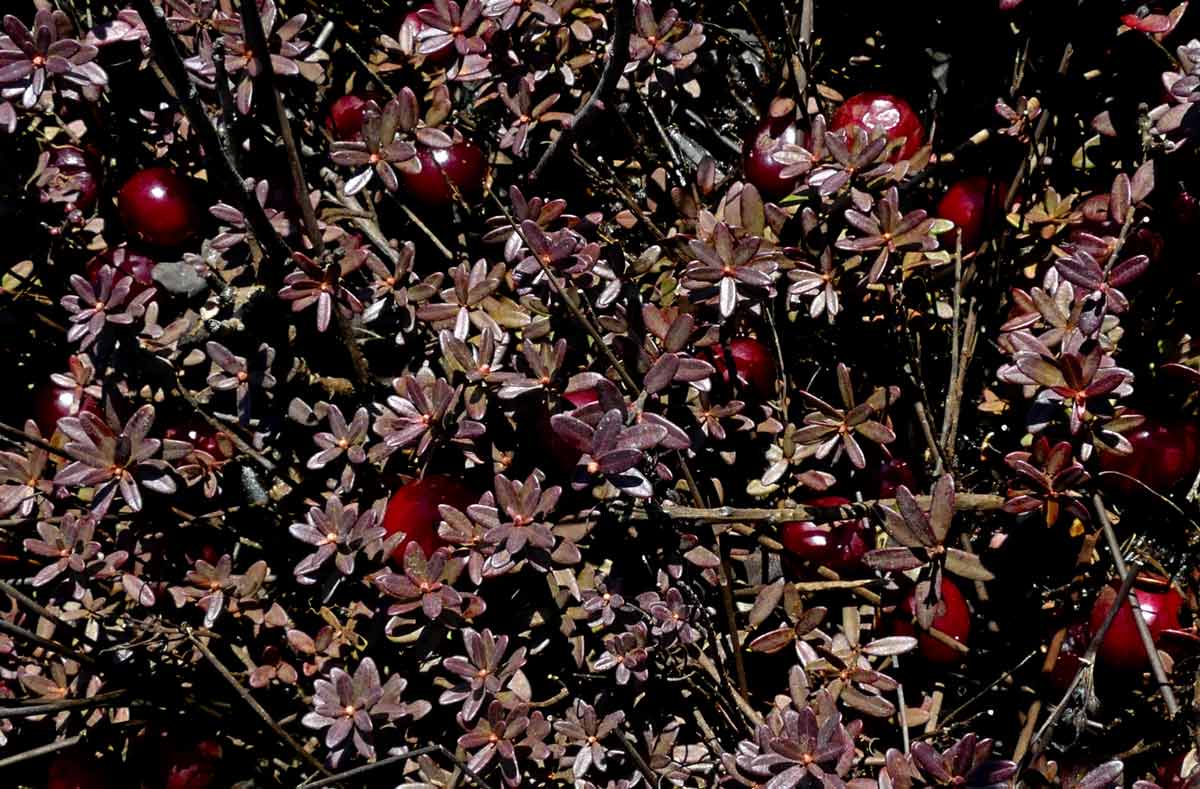
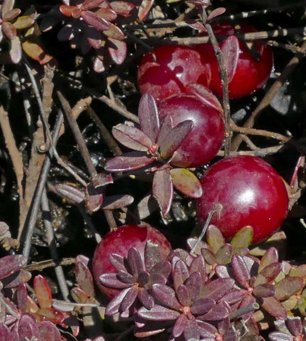 In April, some of last year’s cranberries are still attached to the stems.
Floodwater on the Sandy Plain
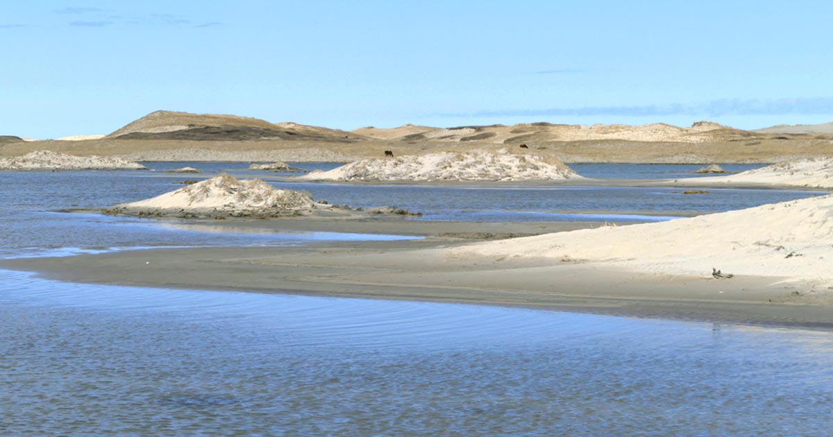 Flooding on the Sandy Plain caused by ocean overwash and heavy rain. A view from the outer edge of south beach towards the northwest.
The Sandy Plain is the very wide section of the south beach that extends for about 9 km eastwards from the Sable Island Station. In the 1970s the area was described as a “vast and featureless expanse of sand” (except for Wallace Lake). By the early 1990s, embryo dunes were forming on the plain and these became known as “The Hummocks”. There are now well-developed vegetated dunes on what was once a “featureless expanse”. As with other sites – such as Lily Pond North, The Dike, Dead Horse Pass, and Steeple Dune – the island’s ever-changing landscape has shifted away from some of the features originally described by the name “Sandy Plain”.
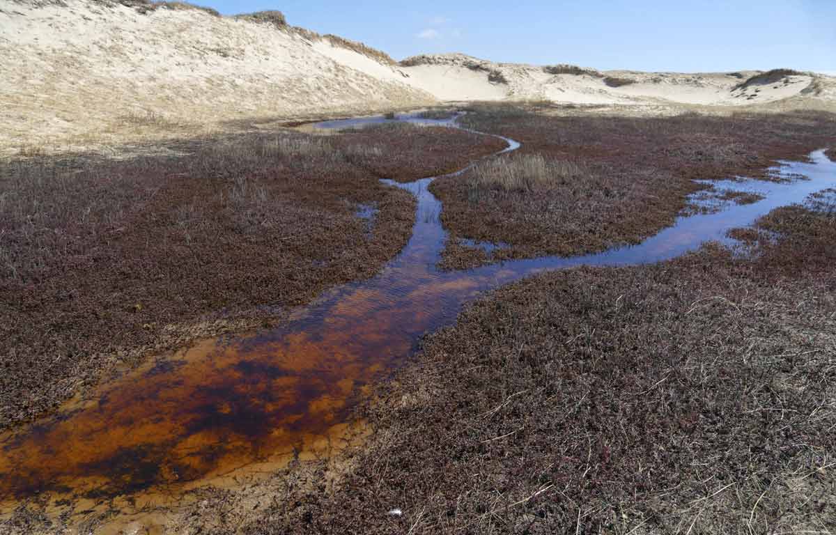
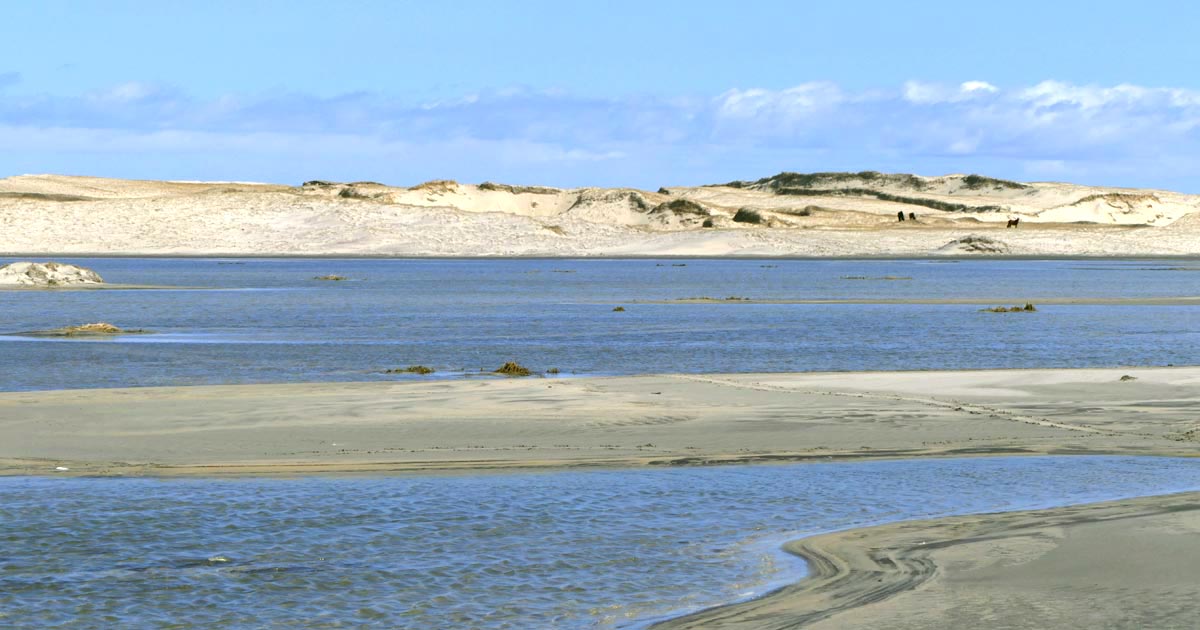 But the plain still floods, especially during during tropical and winter storms, with heavy rainfall and/or waves washing over the berm. This is a view from the outer beach, looking towards the northeast.

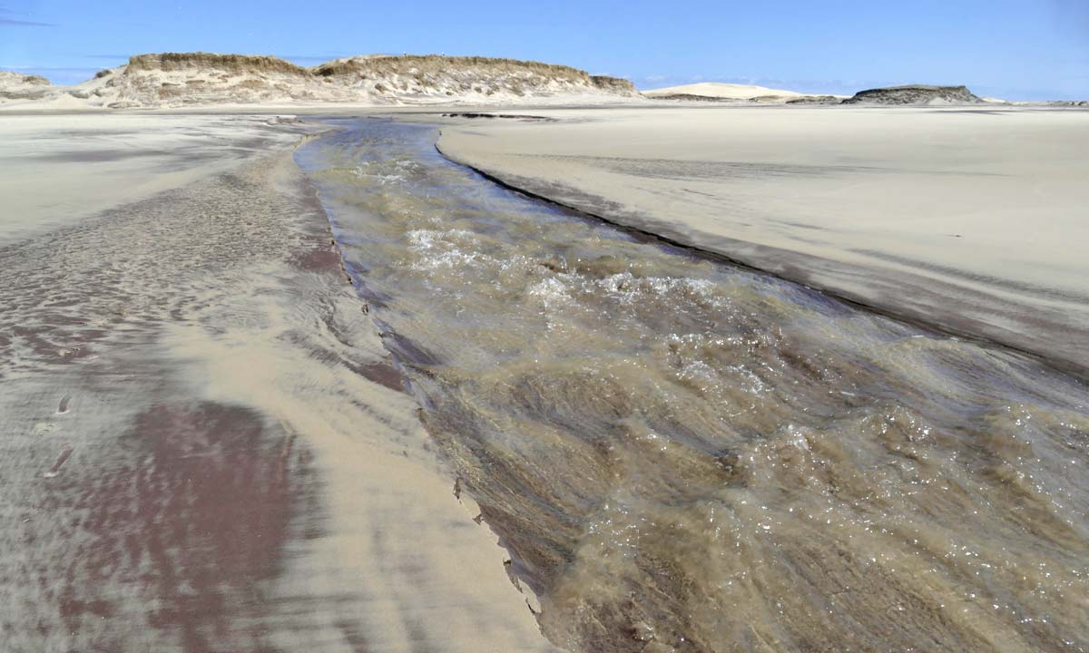 As floodwater accumulates, and sometimes pushed by the wind, the water often carves a river across the berm and flows back into the ocean. Sometimes the stream is a trickle, sometimes splashing rapids, and sometimes so wide and deep that seals get into the river and appear to use it as a water slide.
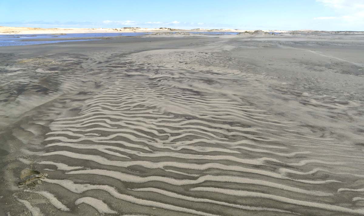 As the floodwater drains away and the surface sands dry, patterns are formed by the action of water and wind.
Cast Ashore by the Waves, Gooseberries
 Sea Gooseberries (Pleurobrachia pileus) washed ashore on the north beach.
Ctenophores, commonly known as comb jellies, live in marine waters worldwide. Their small bodies consist of a mass of jelly, with an outer layer two cells thick. On the outer surface are groups of cilia (“combs”) used for swimming. These are arranged in four pairs of longitudinal rows, and it is the beating of the cilia in synchrony that enables the ctenophore to swim. In Pleurobrachia species, the combination of an egg-shaped body (up to 2.5 cm in length) and comb rows resembles the gooseberry fruit – Sea Gooseberries.
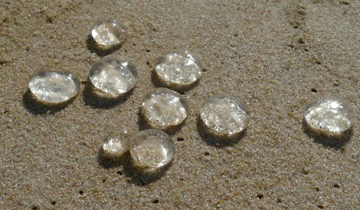 Almost all ctenophores are predators, feeding on a range of tiny marine organisms, from microscopic larvae to the adults of small crustaceans. They catch prey with a pair of long tentacles that are up to twenty times the length of the body.
Also Cast Ashore, Plastic Debris
 A deflated bundle of metallized plastic balloons with a tangle of ribbons. Some of these balloons carry the warning (printed in English, Spanish, and French) “Do not release outdoors or near electric power lines – may cause power outages.”
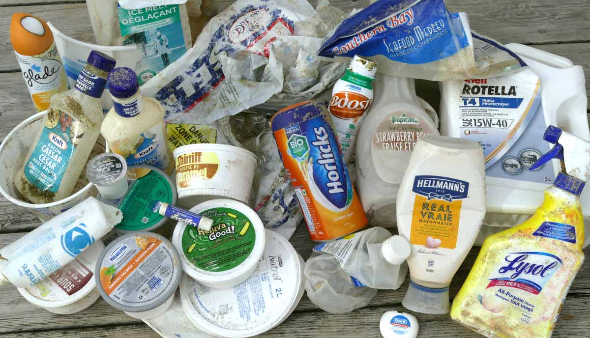 A collection of containers and packaging found during late March and early April.
Brand Audits are one component of the Sable Island Institute’s beached plastics monitoring program (conducted in partnership with Parks Canada which contributes logistic support).
These audits provide information about sources – country of origin, and manufacturers and/or distributors – of single use containers and packaging. This collection includes only some examples of the plastic containers (and many familiar products) that are abundant, in huge and astounding numbers, in North Atlantic waters. All eventually degrade and break up into much smaller fragments, contributing to the ever-increasing burden of microplastic pollution in the marine environment.
 Beached plastic containers are cleaned up and retained for use in development of educational programs, and for reference.
Most containers found on the beach have lost their labels. Since manufacturers commonly use distinctive container shapes, the collection of labelled products will assist with identification of the far more abundant unlabelled plastic containers and fragments found during beach surveys.
The Sable Island Institute’s plastic pollution study not only generates data but also removes a portion of the beached plastic debris from the island. Since beginning the brand audits in summer 2019, 1005 labelled items have been collected, totaling 76 kg of plastic. In weight, that’s equal to 6,300 plastic water bottles. However, over the long-term, even more plastic will be removed during the regular surveys of permanent sample sites to be established along the beach. These surveys will collect and quantify all plastic materials washed ashore, not only labelled containers.
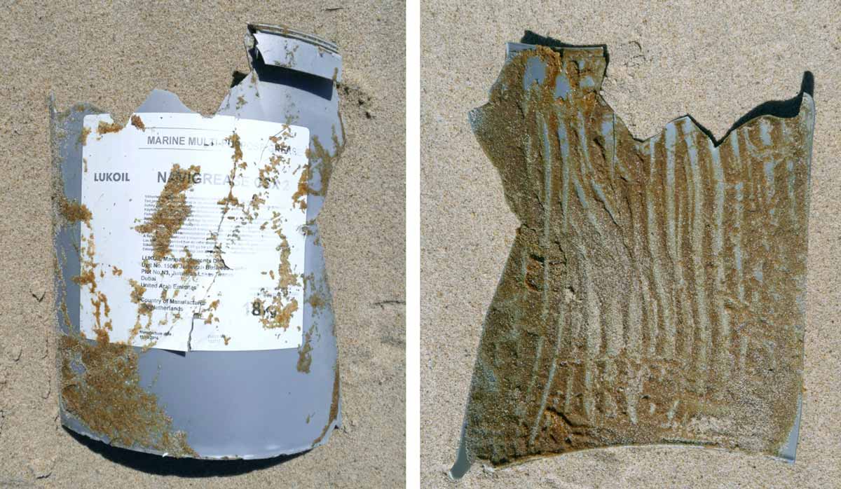 Some of the items collected from the beach still contain all or a trace of their original contents. This is a piece of a broken bucket that would have contained 18 kg of marine multipurpose grease. The other side of the fragment (i.e., the inside surface of the bucket) was covered with grease. Scrape marks indicate there had been an attempt to remove the last of the grease from the bucket.
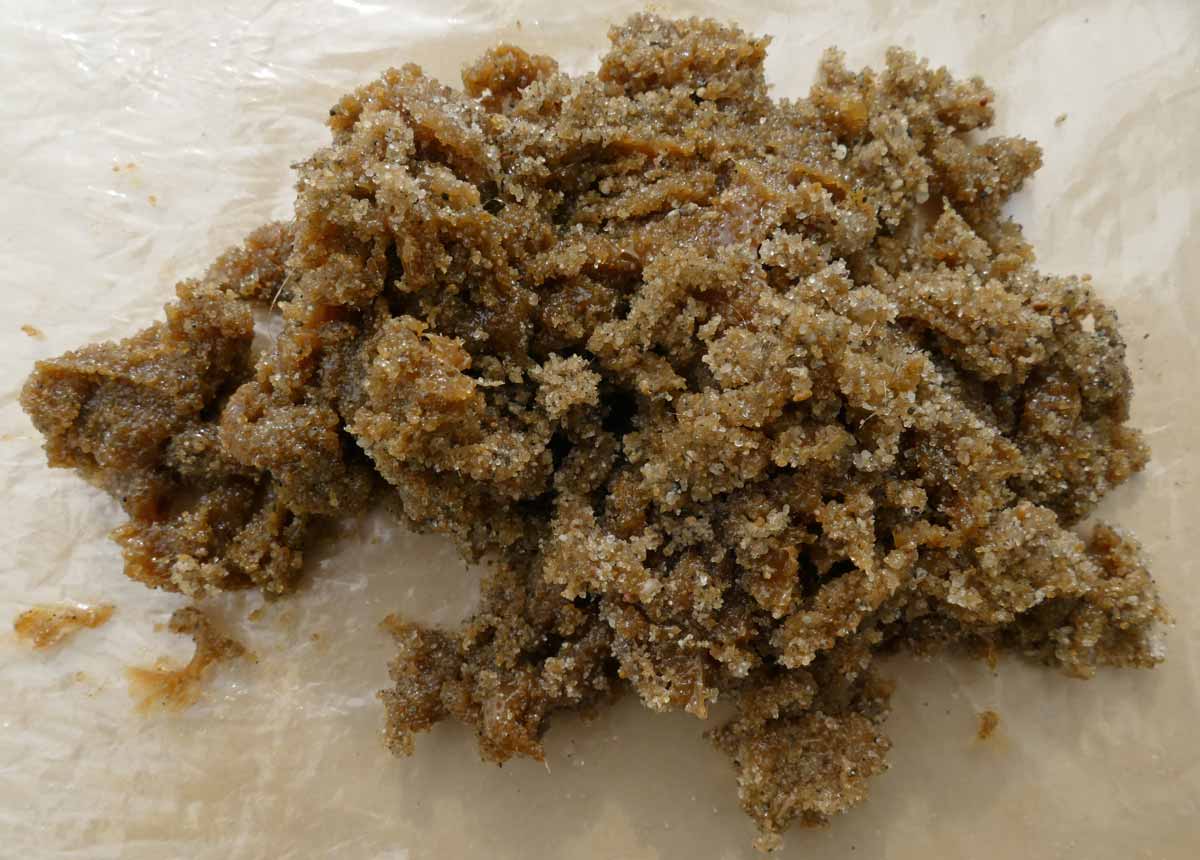 When the residue on the fragment was removed, the sandy glob of grease amounted to about 400 mL. It was appropriately disposed of at the Sable Island Station.
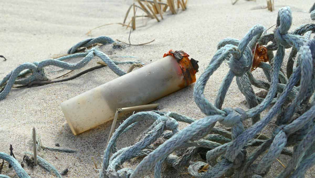 A small plastic tube (10 cm long) was found in an area where wind had scoured away sand and exposed some trawl net and other items on the beach. The tube’s metal screw-on cap was completely rusted and fell away in flakes.
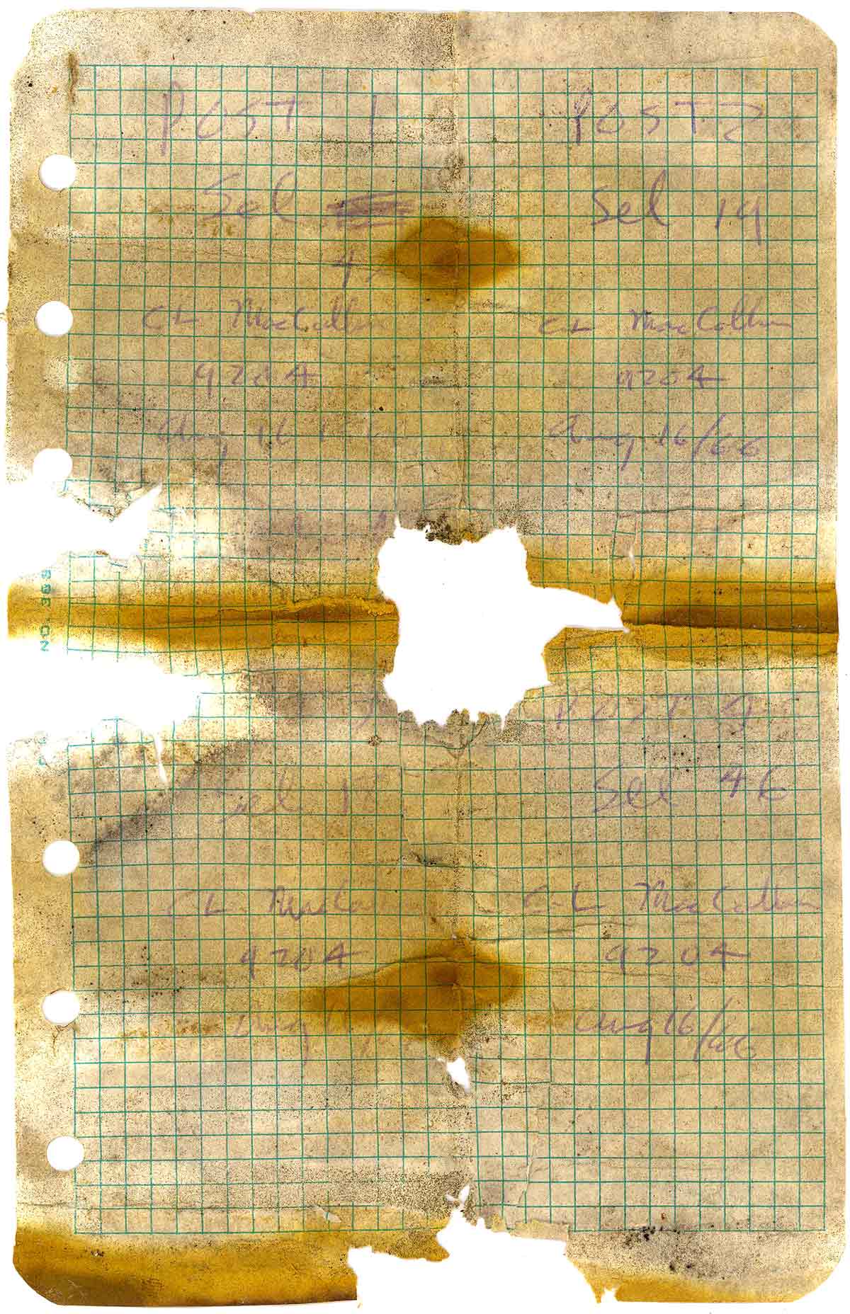
A damp, moldy and discoloured note was found inside the plastic container. It appears to be a page from a field notebook.
The meaning of the hand-written notations is unclear, but perhaps they are a surveyor’s notes. The page is divided into four sections, and in each the same name and date are written. Although difficult to read, the name appears to be “C. L. MacCallum”. The date is clearly “Aug 16/66”. If this date represents when the page was placed in the tube, then the plastic tube is over 50 years old. It may have been buried in the sand for a very long time.
Perhaps someone reading this post recognizes the meaning of the notations and/or knows C. L. MacCallum. If so, please get in touch or leave a comment.
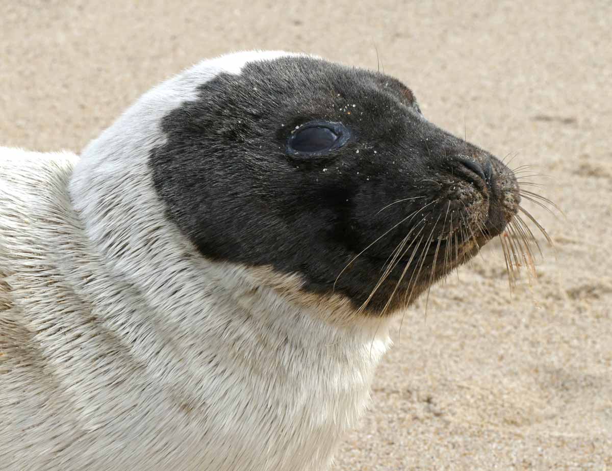
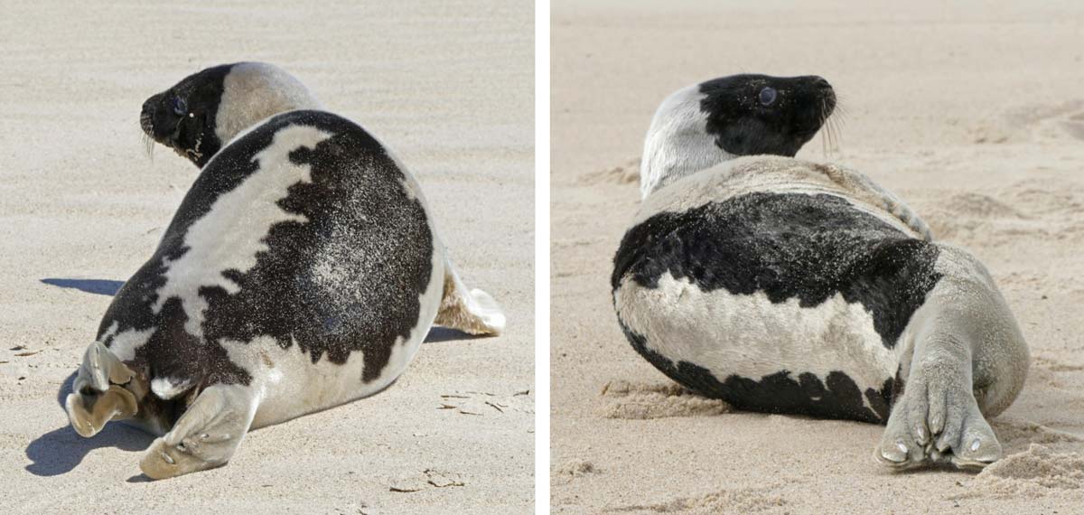
Moulting Grey Seals
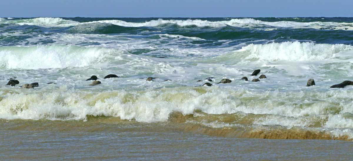 Grey Seals in the surf along north beach.
 A herd of Grey Seals hauled out on north beach. It’s a mild spring day with southwesterly winds peaking at 24 knots and a balmy temperature of 5.9°C.
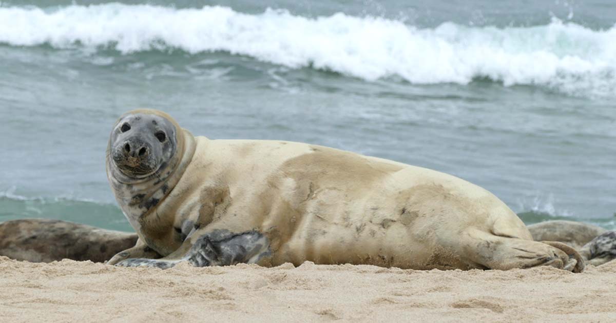
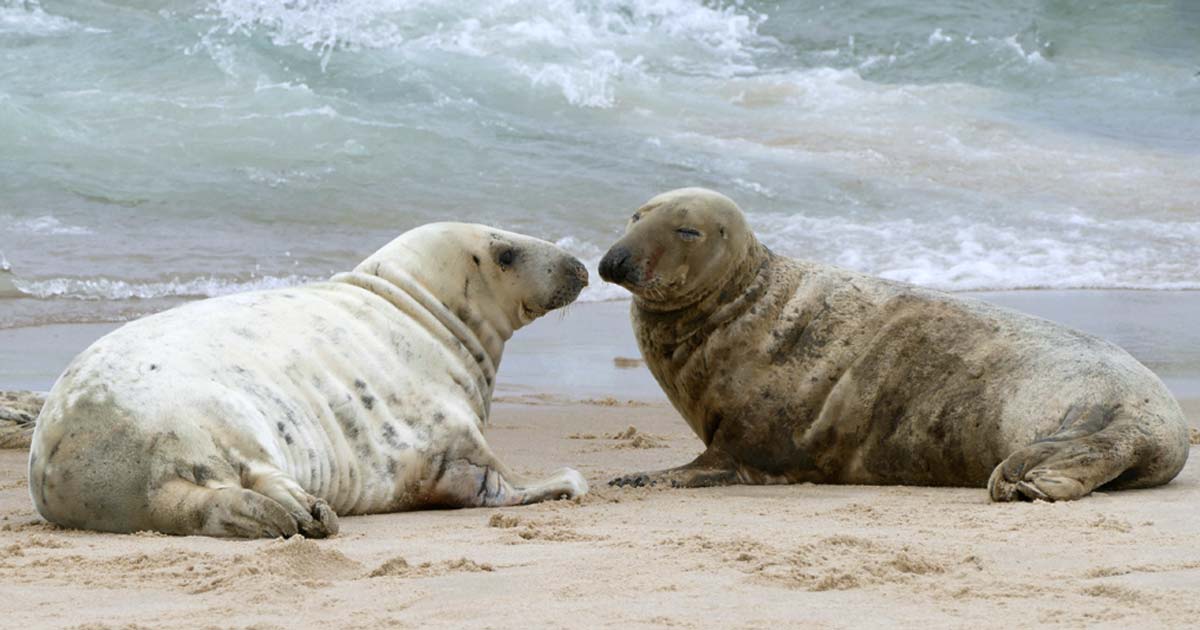
Except for the head and flippers, seals’ bodies are well insulated with a thick layer of blubber. In the banana position, the seals keep their flippers up out of the water that washes over the beach, and so they lose less body heat.
During late March and April, Grey Seals shed their old worn and discoloured coat hair. All seals undergo an annual moult during which they progressively lose and regrow their coat hair. As the moulting time approaches, the Grey Seal’s hair begins to die, becoming increasingly dull and brownish in colour. As patches of year-old hair rub or wear off, the silvery grey and black spotted new coat is revealed. The moult is an energetically costly process. To help the new hair grow, blood flow is increased to the seal’s skin, which may make it more sensitive to temperature (all the more reason to keep those flippers up in the air). To enhance this process, seals spend more time hauled out on the beach during the moulting season.

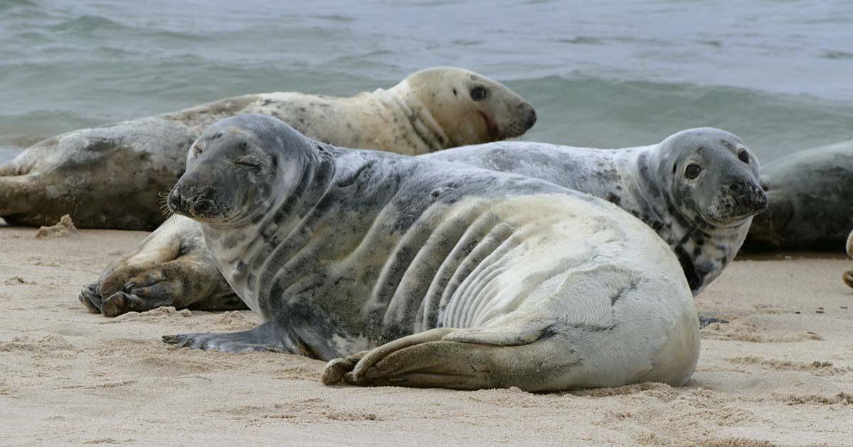 Grey Seals in various stages of the moult.

Transient Harp Seals
Five seal species have been recorded on Sable Island. Harbour and Grey Seals breed on the island. The other three – Hooded, Harp and Ringed Seals – are northern species that normally breed and forage elsewhere, but haul out on Sable in small numbers, usually in late winter and early spring. Although sightings of Harp and Hooded Seals on the island had been rare, numbers increased during the mid-1990s, with juveniles of both species greatly outnumbering adults. Studies documenting the increased numbers and the health status of Harps and Hoodeds on Sable Island were published in 2002 and 2003, respectively.
Ringed Seals are still uncommon on the island. A sighting of another species, Bearded Seal, has been mentioned, but there is no confirmation and no details available for this occurrence.
 An adult Harp Seal on north beach. This species is highly migratory, and individuals often wander far from their normal range. During late March and April there were at least 10 adults hauled out on the north and south sides of Sable Island.
 Individual adults can be distinguished by unique variations in the pattern of black and silvery-grey on their backs.
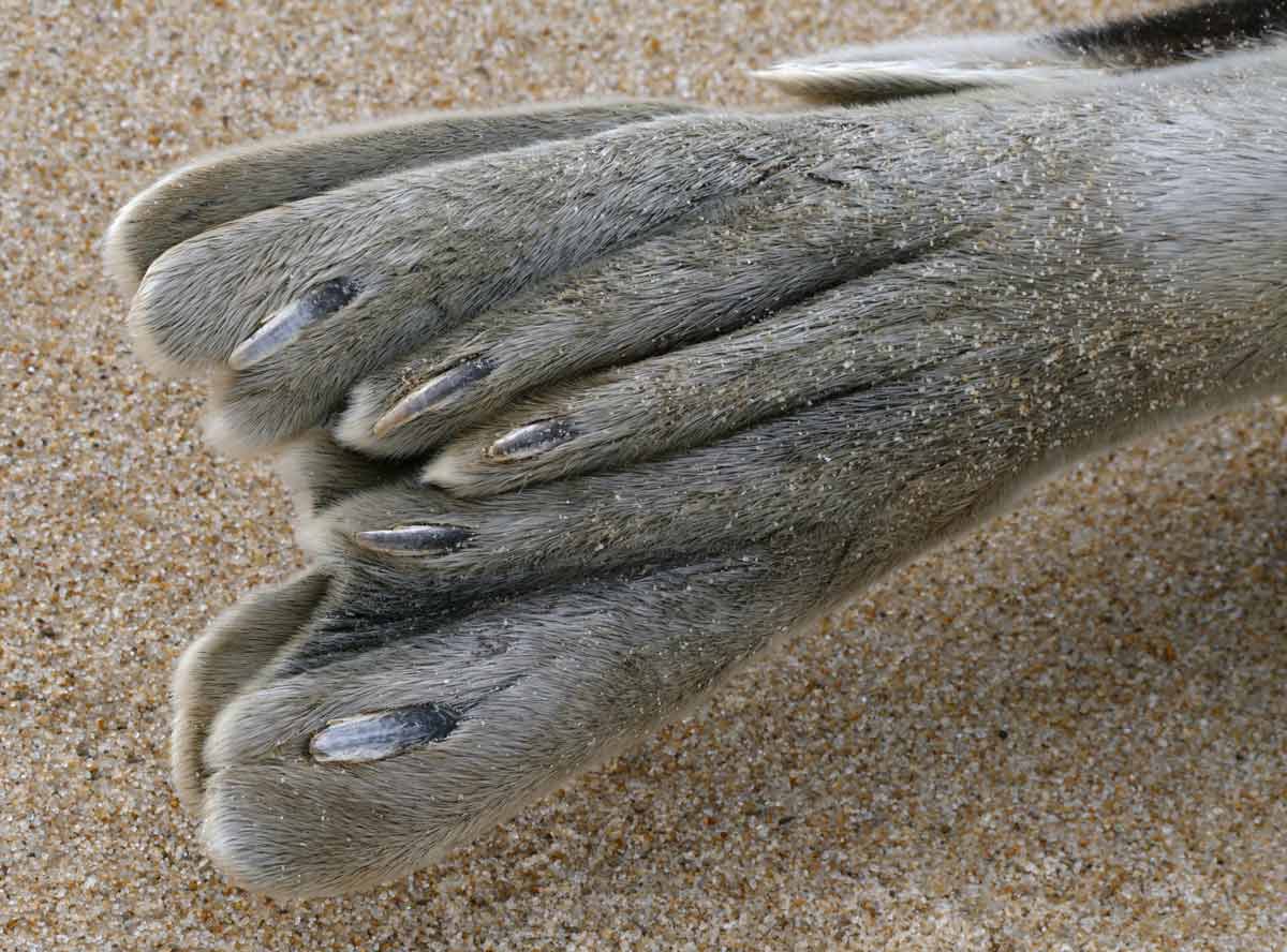 A Harp Seal’s hind flippers, pressed together, a behaviour (as seen in the banana posture) that can reduce heat loss.
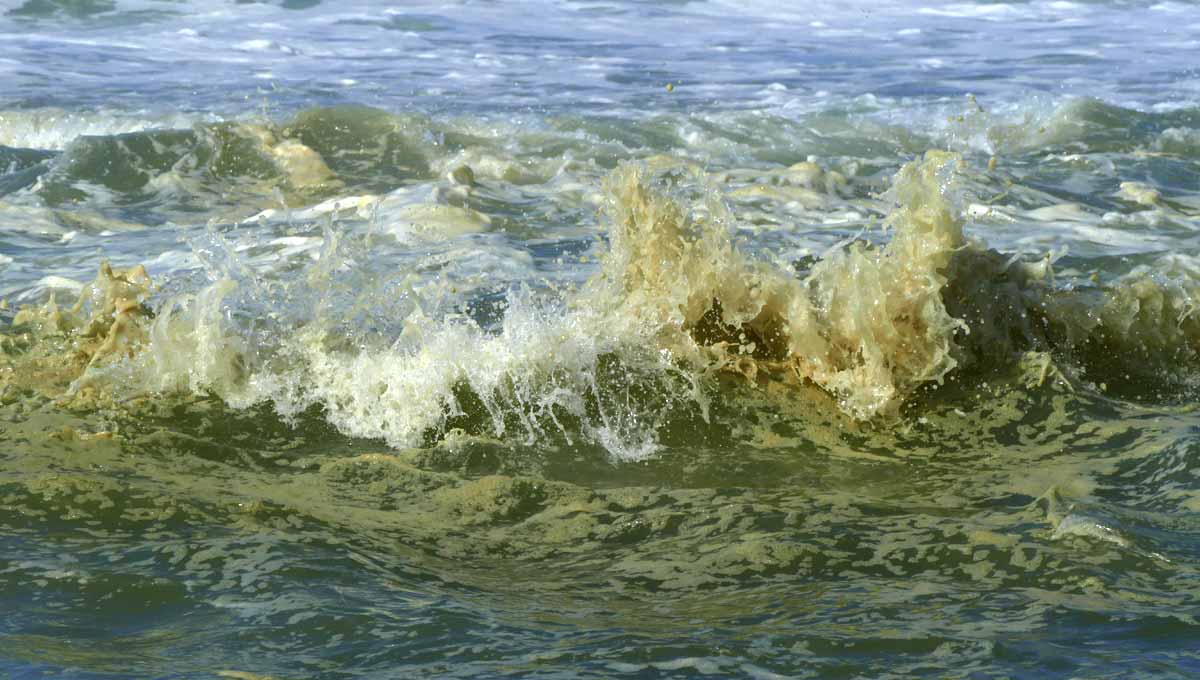
Greenish Foam Along North Beach
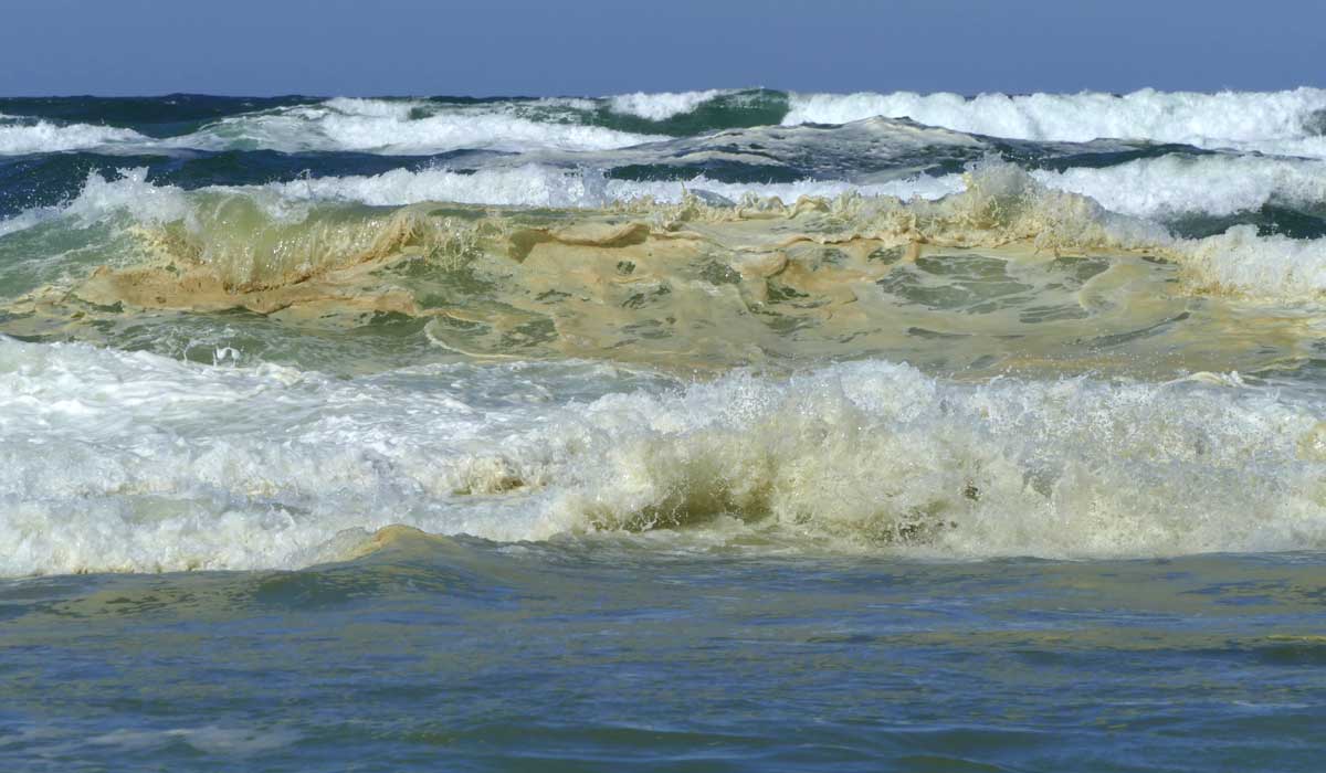 During a breezy spring day, with northwesterly winds peaking at 38 knots, a greenish sea foam is carried in by the waves along north beach.
Sea foam is a created by the agitation of seawater, particularly when the water contains high concentrations of organic materials (e.g., decomposed plankton, algae, protozoans, fungi, fragments of beach plants and dead birds, pollen, and/or some contaminants). The specific contents of sea foam can vary by season and location.

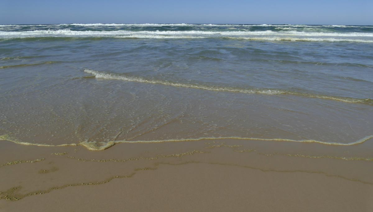
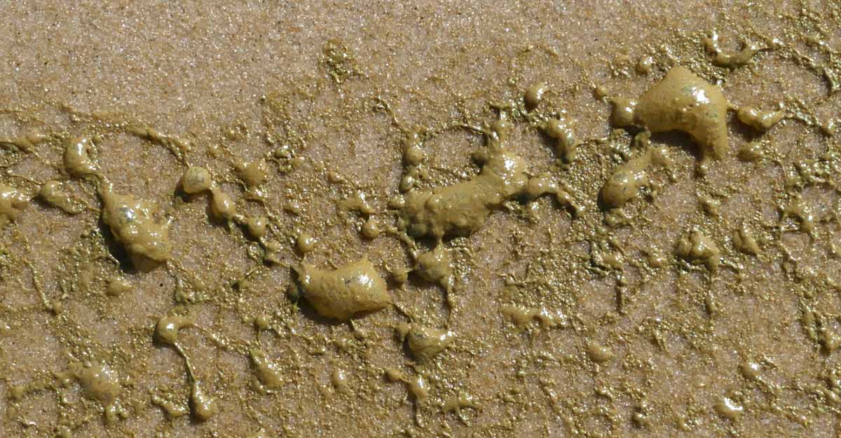 As the waves swashed ashore, the residue of greenish sea foam on the beach looked like beads of molten metal.
A Sunset Stroll and a Large Moon
 Footprints of a gull taking an evening stroll.
 South beach surf catching the sunset glow. It had been a warmish day (maximum 5.2°C) with a light northwesterly wind peaking at 11 knots.
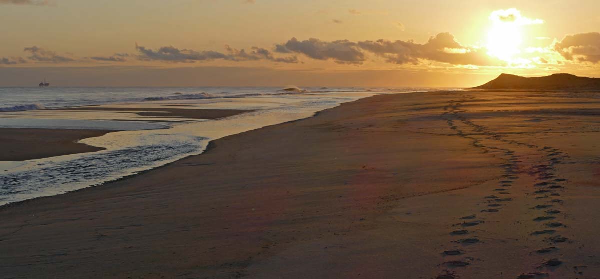 After a checking for birds in the West Light area, Greg Stroud and I walked back along south beach. We looked behind us to the west and saw the setting sun.
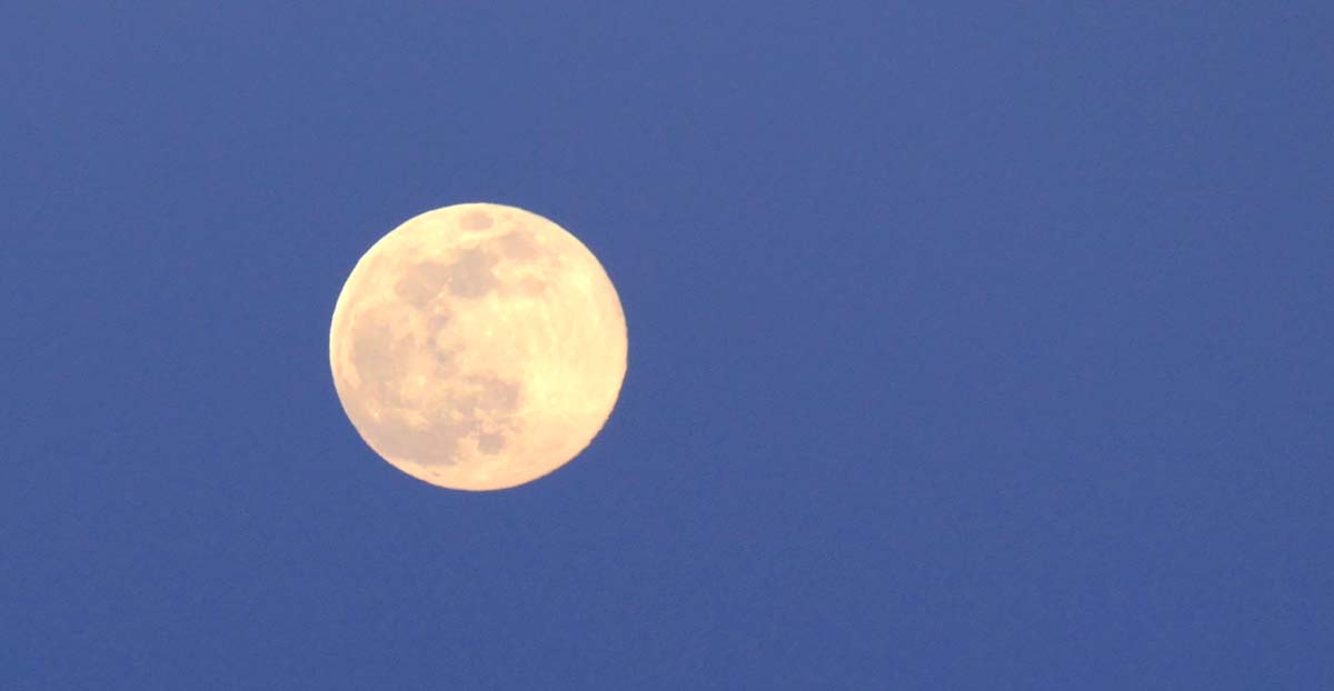 And we looked to the east and saw a huge full moon in a curiously coloured sky. It was the evening of April 7th.
This full moon was the first to occur after the March equinox, which made it the first full moon of spring. It was also a supermoon, one of only three occurring in 2020. The other two were on March 9th and May 7th. But since this moon was closer to Earth than the other two, it was the biggest and brightest full moon of 2020.
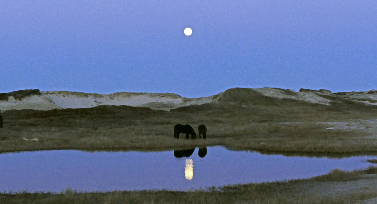 Two Sable Island horses grazing near a freshwater pool in the light of the rising moon under the dark lavender sky.
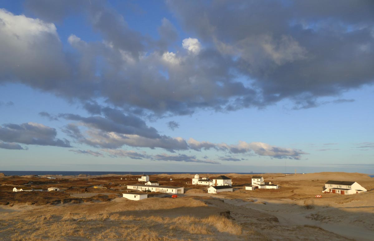 A view of the Sable Island Station the next morning (6:45 am), looking westwards. The setting full moon is still above the horizon, but is covered by the tail of cloud. It’s the start of a mild spring day, with southerly winds peaking at 20 knots, and a maximum temperature of 6.7°C.
A Sable Sun Disk
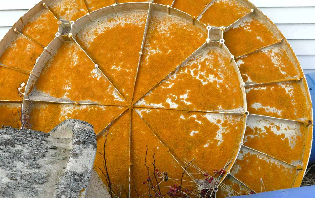 The underside of satellite dish covered with lichen, mostly Xanthoria (sunburst lichens). Prior to becoming an artwork, it served as the communications dish for the station’s Canadian Lighting Detection Network (CLDN) sensor. The 2 m diameter fibreglass dish was decommissioned about five years ago, and has been leaning against the south-facing back wall of a small storage building.
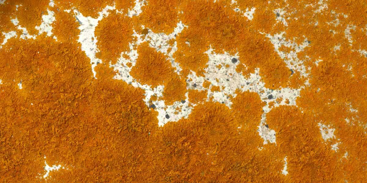 Even a small detail of the lichen-covered surface is remarkable – a splendid example of nature’s palette, or a satellite image of a far off alien landscape (that of Planet Xanthoria, of course).
The results of a 2007 survey of lichens on Sable Island were published in 2009: The lichen flora of Sable Island, Nova Scotia: its past, present and likely future status. Two Xanthoria species – Xanthoria parietina and X. polycarpa – were recorded on Sable where they are commonly found on bone, concrete, and wood. Fibreglass surfaces can be added to the list of substrates for these sunburst lichens on the island.
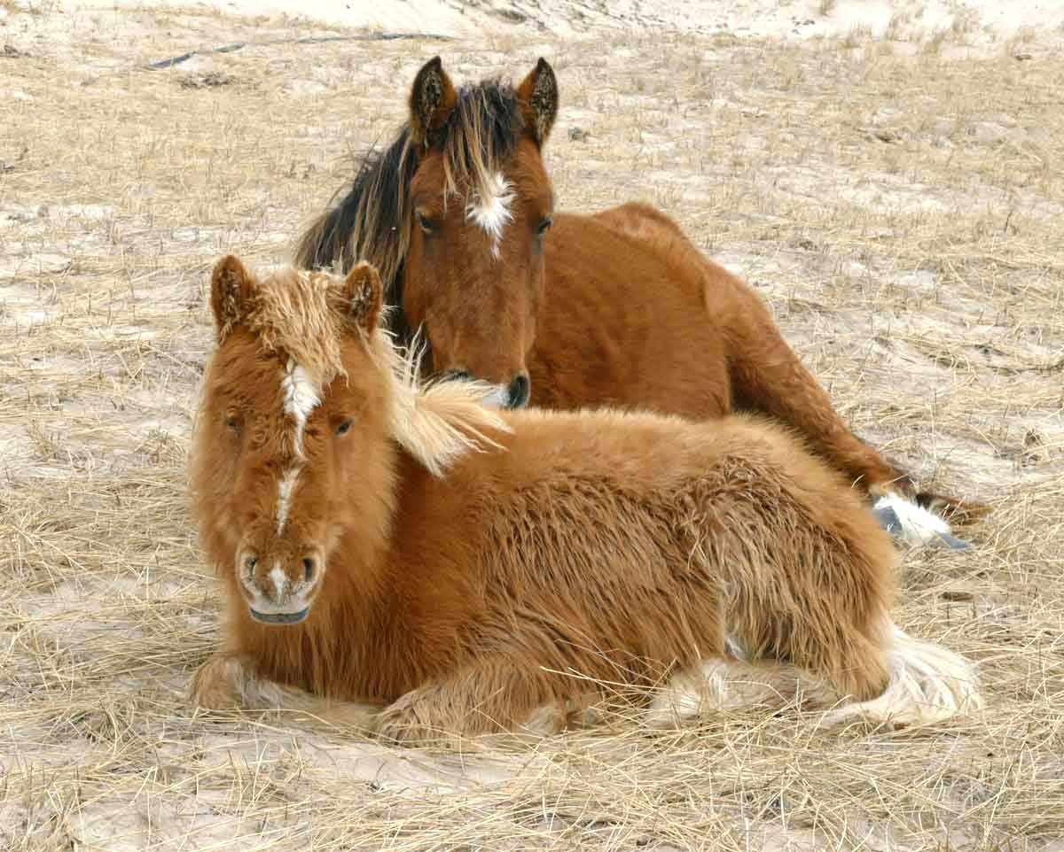 A bay mare and her chestnut yearling (born in 2019) resting in a sheltered hollow. Peak winds were northeasterly 21 knots, with a maximum temperature 3.9°C. A peaceful spring day on Sable Island.
Zoe Lucas, May 10, 2020
Sable Island Institute
See the Parks Canada website for the latest updates on COVID-19 at Parks Canada locations.
9 Responses
I have no words. have relooked at least 5 times. thank you so much for sharing, if I cant make it in person I can make it through you/ Beautiful photos
I have been made aware of this enigmatic place clinging to the continental shelf making home for a few caring humans and drifters. Aside from the horses of unknown source, it is inhabited only by transients from the sea and air. So strange that horses flourished where even rats failed to take hold. In a way, the horses ARE the island since their dung forms the medium for nitrogen fixing bacteria and water retention in the soil which provides the loam which grows the plants which grow the horses. Sable is a horse garden. The lichens are a primitive observer of the birds which stop in for gas and perhaps a maternity ward, before the second leg of migration.
thanks from Rick Smith
Your photography is always wonderful showing the moods of Sable Island.
.“C. L. MacCallum”. The date is clearly “Aug 16/66”. -This is just a guess – I do not have access to BIO right now but could followup if you wish -I think this note is from a surveyor with Canadian Hydrographic Services at BIO or from the oil exploration groups surveying offshore because the timing is about right and because they often used codes like SEL for their navigation stations. -they usually had three navigation stations onshore to triangulate their position offshore. It would be best to contact CHS to see if he was an employee at that time.. .
these pictures are simply wonderful. We are sick about the fact that our trip got cancelled which would have included a visit to Sable Island. The photos show just how amazing it would have been
Zoe tells the story of Sable Island with a mix of stark reality and never-ending wonder. Her images illustrate what she is saying perfectly. I was transported back there and it felt like I had never left. Thank you, Zoe, for sharing your spring time impressions in all their splendour. Sable Islands remains one of the most special places in the world.
Zoe, these photos are just great. They bring back memories of my trip to Sable Island with Adventure Canada, I think in 2014.. It was an unforgettable experience. Your photos illustrate the beauty and the uniqueness of the island and also remind us of the problems we have to address with all our oceans.
I absolutely love all the images of Sable Island you’ve shared with us here, Zoe. They have so heartwarmingly carried me back to the Summer of 2017 when I came to visit Sable Island and also when I met you, working at the Station. I have some of the most remarkable photos from my time wandering the dunes, strolling the sandy beaches and of course visiting the Station and I’ve enjoyed sharing the images, including the ones I look if you demonstrating some weather equipment. My son said you took on the air of a wizard, full of expressive wonder! That really describes my experience on Sable Island: a place of incredible wonder. I feel I have made an indelible attachment with all the Island’s inhabitants; I especially feel I know the horses when I see images of them and I would be very happy to be able to meet all the foal I saw that summer, now all grown up! Thank you for sharing Zoë; it’s the next best thing to being there once more!
Glad to see you are still kicking Zoe. Met you in 1999 when I was on the island to repair the auto station. My stay was extended due to heavy fog. Flew out on the 10 day. Filled my days with exploring, beach combing and reading. Actually repaired your atv for you. Stay well.
Hello, my name is Greg Parsons, I worked for Martime Tel &Tel, and used to travel to Sable on a regular basis installing and maintaining the 2 way radio equipment that served the island and the off shore oil business in from 1980’s to the late 1990’s. Sable Island is the most fantastic place I have ever been to., it’s remote location makes it such a rare place. The horses, seals, and migratory birds are a rare treat to see. Not sure if you remember me or not Zoe, but I have met you on a number of occasions on my trips to the island. I still hope to get out there again before I die just to see and experience this truly amazing place again.