David Millar, a Personal History with Sable Island, 1967-1969
 A winter view, in 1968, from the top of the West Light tower, looking towards the east, with the freshwater pond system (the West Ponds) to the right, and the buildings of the weather station in the distance. In the foreground is the radio operator’s office and living quarters.
In the fall of 1966, after finishing high school in Dartmouth, Nova Scotia, I joined the weather service – then called the Meteorological Branch of the Department of Transport. After basic training in Ottawa and Toronto, I arrived on Sable Island by air in May 1967. While being fairly close to home (about 300 km away), Sable in fact was quite isolated, relying on irregular flights from Halifax and the three or four visits a year by Canadian Coast Guard vessels to resupply the weather station and check on the automatic East Light. Especially in the winter it could be up to a month between flights which depended on weather and landing beach conditions.
Being my first employment, I quickly got into the work routine. Outside of work I took an interest in the island environment and developed two hobbies which I still enjoy – bird watching and photography. I regularly walked in the general area of the weather station and the West Light around the numerous freshwater ponds (many now destroyed by dune erosion on the south side). Always my walks involved a stop at West Light to visit the power plant operator Norman Bell and his wife Christel. Longer walks took me to the end of the dunes to the west and about 3 km to the east along Lake Wallace. With groups I went as far as the west tip and to the end of the dunes to the east. During my two summers I occasionally assisted Dr Ian McLaren of Dalhousie University and his students in their studies of the Ipswich Sparrow.
I also enjoyed the contact with the horses around the weather station, especially the mares and foals which were quite approachable. Some of the horses, stallions and mares, had been named.
I went on one vacation while stationed on Sable Island, leaving by Coast Guard vessel in late summer of 1968 and returning about four weeks later by air. I finally left Sable in June of 1969, and my next posting was in Goose Bay, Labrador. I still have fond memories of the island.
 A view of Sable Island from the deck of the Ocean Endeavour as it sailed westward along the island’s north shore, June 23rd 2016. The white dome of the weather office and other structures at the Sable Island Station are visible above the north beach dune line.
In June 2016 I returned to Sable Island with Adventure Canada. The ship Ocean Endeavour was anchored off the north side of the island for four days and I went ashore twice. I had hoped to visit the weather station but was unable to get there since the site where passengers were brought ashore was about 10 km east of the station. However, when the ship moved from its first anchorage near Bald Dune to the west tip, I had a good view of the island and noticed changes that have occurred during the intervening forty-seven years. Two changes that stand out are the retreat of the dunes on the north beach near the weather station (the buildings were not visible from the water in 1968 due to the height of the dunes), and the growth of the west tip. In 1968 the west tip was less than 10 km from the weather station while in 2016 it was about 15 km to the tip.
Sable Island 1967-1969
Meteorological Branch of Transport Canada
 The weather station staff house, living quarters for single men, 1967.
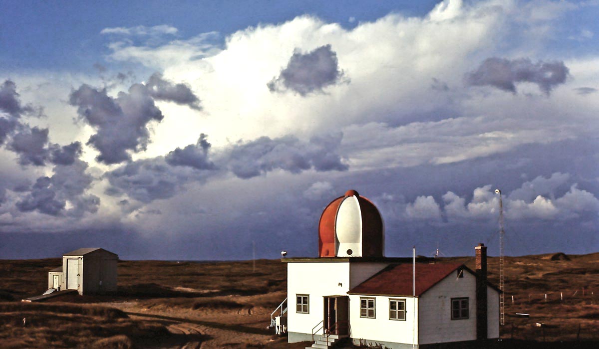 The weather office and hydrogen shed at sunrise, with heavy cumulus clouds, 1968.
 Heavy snow on Christmas morning 1967 – a view from the window in my room in the staff house.

 Two views of the weather office and equipment, with a young me at work, 1968.
 Balloon launch, a high wind release, winter 1969.
 The weather station in winter, 1969 – left to right, the barn, the observation deck, the office, and the staff house.
The West Light Area
 West Light tower and associated buildings on a cloudy but calm day in winter 1969.
 Quonset buildings used for the generator and storage at West Light, viewed from the top of the West Light tower, with the tower’s shadow cast over the scene.
 The skeleton of a Quonset building that was destroyed by a hurricane. Located closer to the north beach dune line near West Light, it had been used as a warehouse.
Mobil Oil Canada
 Mobil Oil camp located near the centre of the island, 1967.
 Mobil Oil drilling on Sable Island, the first hole on the Scotian Shelf, summer 1967.
Sea and Air Operations
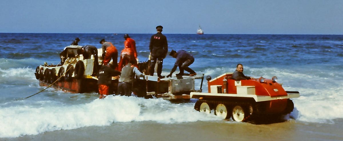 Unloading supplies for the weather station with the Canadian Coast Guard vessel in the distance, in 1968. The supplies were brought from ship to shore in a motorized barge and loaded into a small trailer backed up to the barge. The trailer was towed and maneuvered by a tracked vehicle, here driven by the station’s Officer In Charge, Fred Androschuk.
 The Piper Apache aircraft that brought me to Sable Island in May 1967.
 A Piper Aztec aircraft on the south beach with Mobil’s Nodwell tracked vehicle nearby. The dark areas on the beach are patches of heavy mineral sand common on the island.
 A mechanic brought in to replace a damaged propeller on the Beech 100 aircraft used to support Mobil operations on the island, 1968.
 The bent propeller removed from the Beech 100. The prop was damaged when the aircraft hit a soft spot on landing and the blades contacted the ground.
 The new propeller installed on the Beech 100. The mechanic was flown in with the replacement prop on a Canso amphibian aircraft that landed on Lake Wallace. He was able to complete the work in a day.
Sable Island Humane Establishment

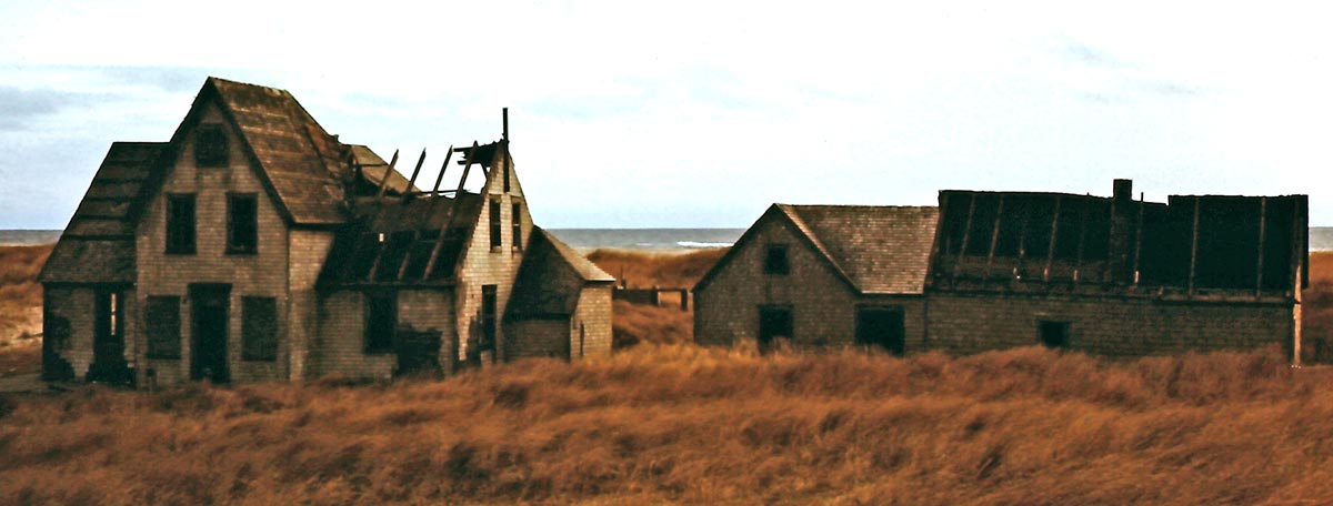 Two views of the abandoned house of the Superintendent of the Sable Island Humane Establishment (SIHE). The site, now called Old Main, was closed in 1959. The first photo was taken in January 1968, and the second was taken a year later and shows storm damage to the buildings.
 Ruins of a barn at Old Main, 1968
 The abandoned staff house at Old Main surrounded by sand dunes, 1968.
 Ruins of a radio shack near West Light, 1968.
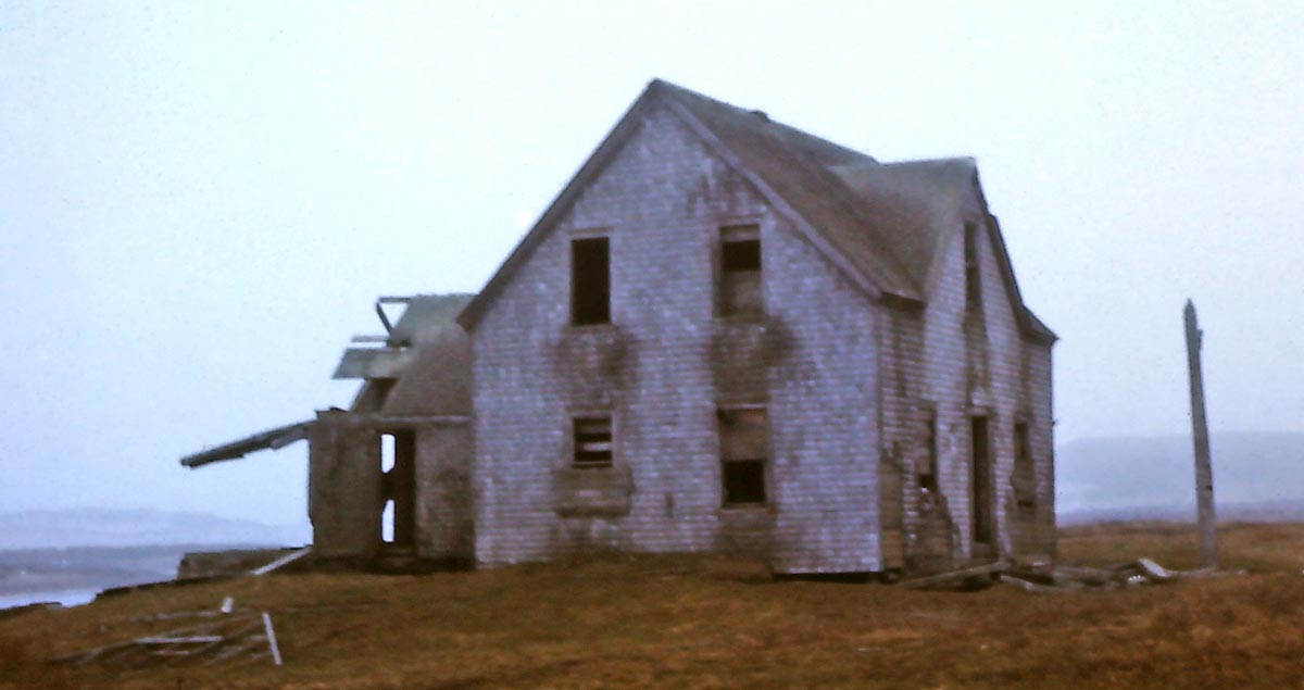 The abandoned house at the No.3 station (SIHE), near the south beach east of Lake Wallace, 1968.
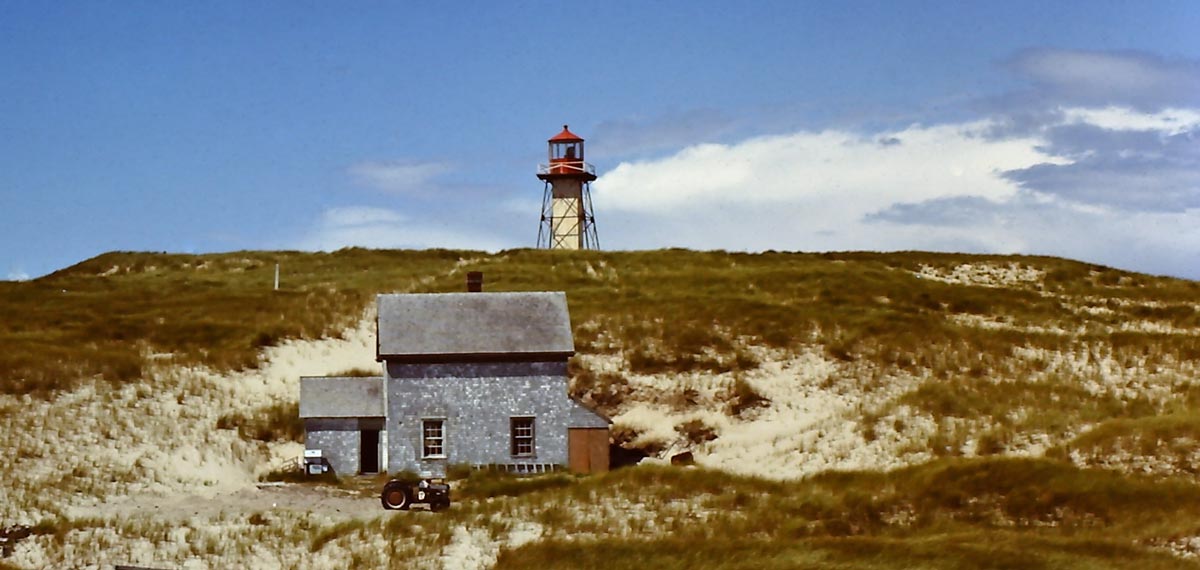 The light keeper’s house at East Light in 1968. No longer used by a light keeper (since the light had been automated), the building was used seasonally as a field camp by researchers.
 The light keeper’s house at East Light in 1968.
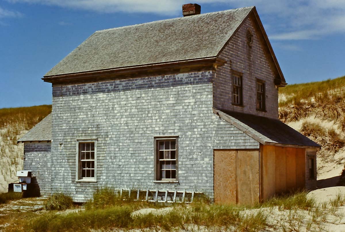 The light keeper’s house at East Light in 1968.
 Sable Island’s East Light tower, 1968.
 A mast of the 1947 shipwreck SS Manhasset which went aground on south beach, as seen in 1968. The mast, the only above-the-surface sign of the wreck remaining, was swept away in winter 1968-69.
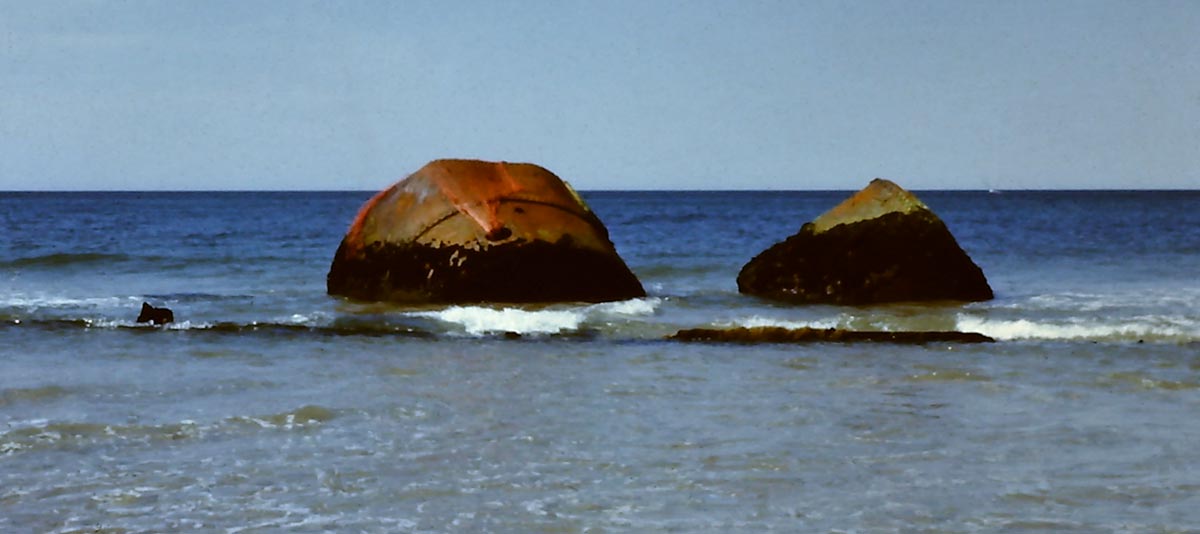 The boilers of the 1906 shipwreck SS Skidby which went aground on the north side near centre of Sable Island, as seen in 1968.
Flora and Fauna
 Three palm trees planted on a small island in the centre of a freshwater pond in summer 1968. They didn’t survive the winter.
 A young pine tree sapling also planted in summer 1968, and it did not survive.
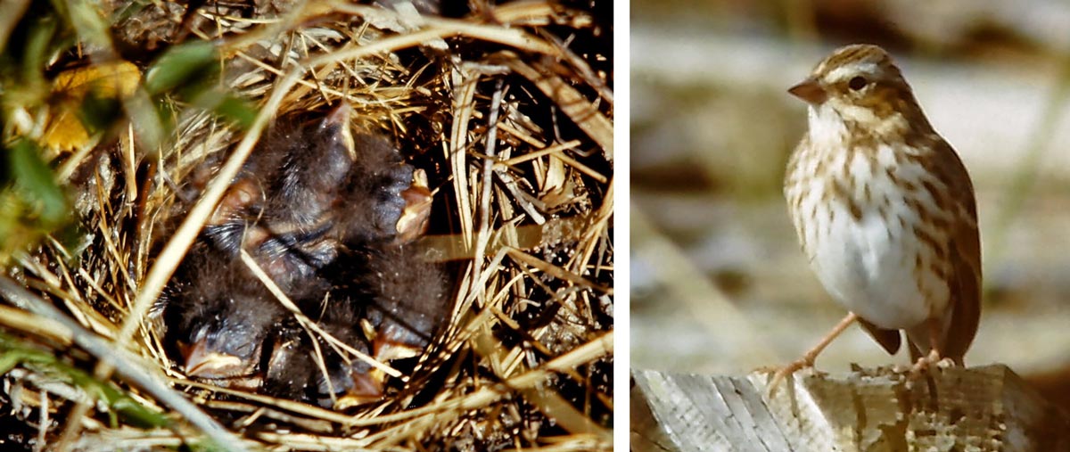 Ipswich Sparrow – a nest with five chicks, and an adult. This bird nests only on Sable Island.
 A Boreal Owl found in December 1968. The owl, named “Click” was kept in Christel Bell’s greenhouse at West Light until it could be taken back to the mainland on a returning aircraft.
 A Sable Island mare Lady and her foal Misty near weather station in spring 1969.
 Nathan in late autumn, 1968. He did not survive the winter of 1968-69.
Surf and Sunsets
 Surf along north beach, 1968.
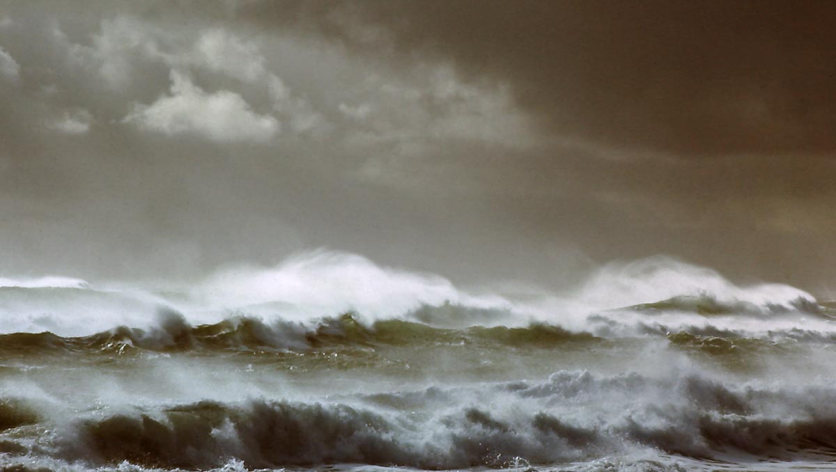 Heavy waves along the south side of the island, being blown back by a strong north wind, 1968.
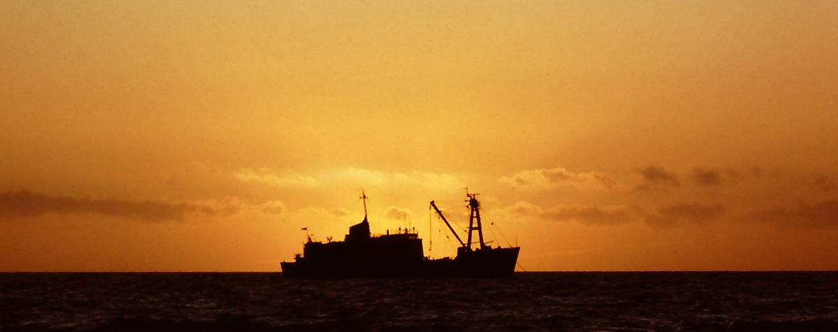 Sunset with the Canadian Coast Guard ship CCGS Narwhal anchored off the north side of Sable Island, 1968.
 Sunset over Sable Island, 1968.
All photos taken by David Millar
Prepared by Zoe Lucas, Sable Island Institute, February 2020
For more information about the Meteorological Service of Canada (MSC) on Sable Island, see:
MSC’s Aerological Program Ends After 75 Years of Service
Merlin MacAulay, Fifteen Months on Sable Island (1955-1956)
Full Circle, Gordon LeBlanc (1963-1964)
Clean-up of an Old Fuel Cache

One Response
Be fun to see the same subjects all these years later.