Sable Island’s Roll Cloud of June 13, 2003
Since 1976, six roll cloud events have been observed at Sable Island by personnel with the Meteorological Service of Canada (MSC) and/or by Zoe Lucas. The most recent occurred on July 9th, 2019, and some visitors and Parks Canada staff also saw the cloud.
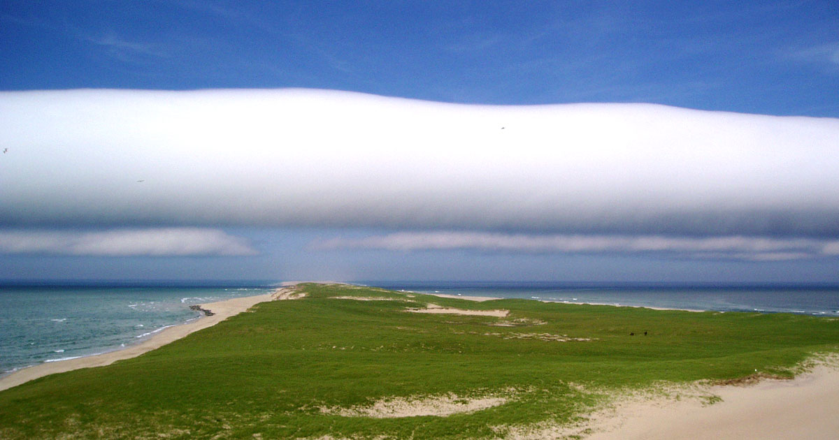
Of the six events, the 2003 roll cloud is the best documented. Although it is included in the review of the island’s roll clouds, twenty-two additional photos are provided here. Photos 4 to 22 are arranged in three series showing the cloud as it approached and passed overhead. The cloud was roughly 40 km long, extending across the island out over the ocean to the north and south horizons.
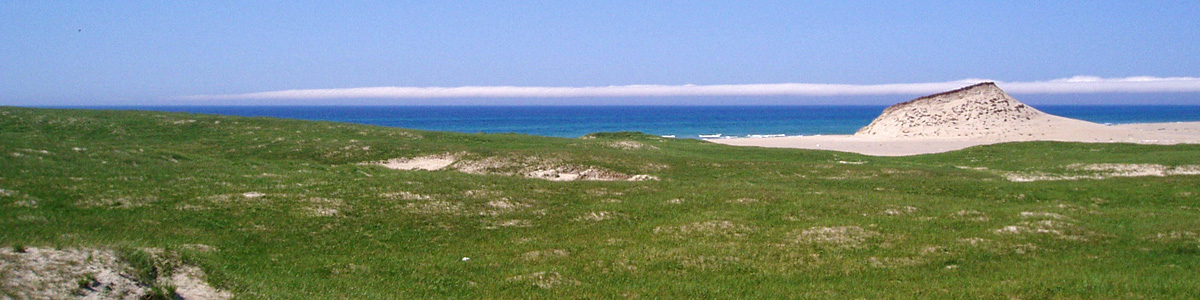 1. View towards the northeast.
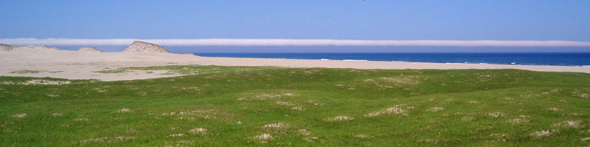
 2. View towards the east.
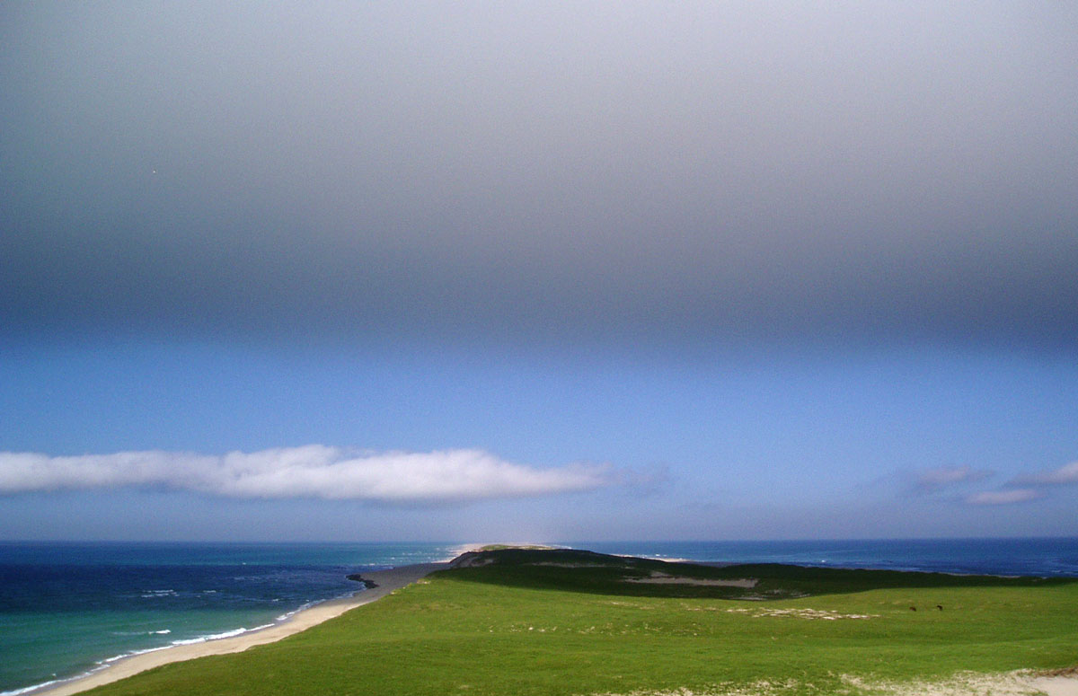
 3. View towards the southeast.
Photos 1, 2 & 3, above: The cloud was clearly visible on the eastern horizon long before it actually reached the Sable Island. While recording horse activities on Kearny Dune, ZL stopped to take these photos, and then, to get a better view, traveled farther east to a position on the high dune in the distance. All the following photos were taken from that location.
Photos 4 to 22 in three series, each showing a different view of the roll cloud as it travelled roughly southwestward over the east end of Sable Island.
Photos 4 to 10 show views of the cloud as it moved over the east end of the island.
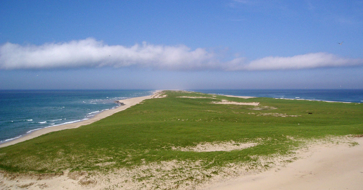
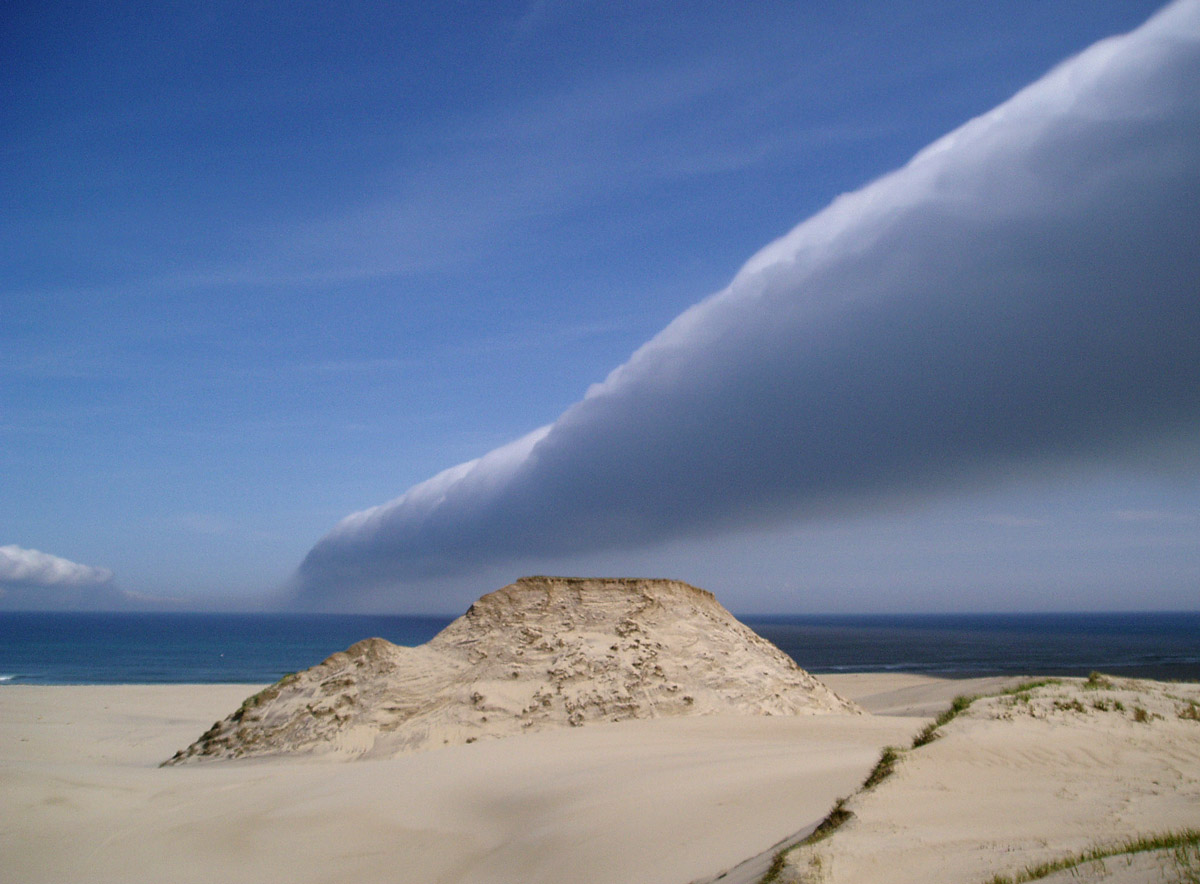
 4. The roll cloud seen from the top of a high dune, looking towards the island’s east end, across Steeple Dune, with Long Dune and the East Spit in the distance.
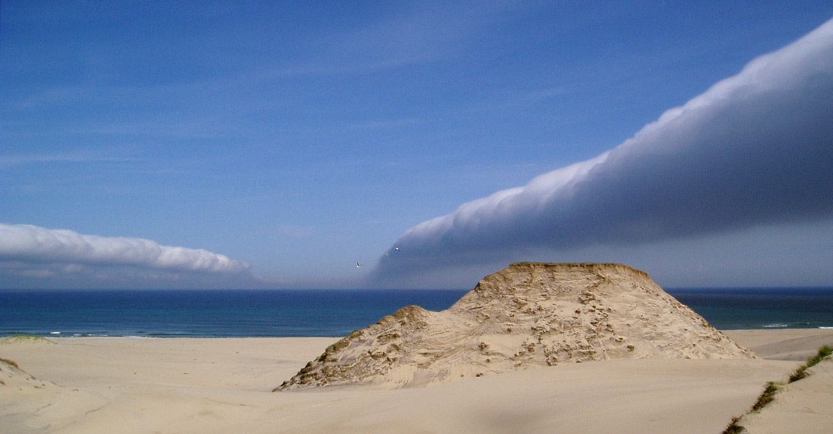
 5. As the cloud approaches, its position relative to the island is indicated by the shadow cast across the landscape and surrounding ocean. The cloud’s shadow is visible as a dark line on the distant water, and indicates that the cloud is approaching Long Dune. Twelve minutes have elapsed since photo no.4 was taken. Two horses (tiny dark spots near the right side of the frame) are grazing beach grass and wild pea in the Steeple Dune area.
 6. Rapidly moving, rolling toward the observer, the cloud is over Long Dune. A line of scattered cumulus, is parallel with, and following, the cloud.
 7. Beneath the dark grey underside of the approaching cloud, the shadow sweeps across the landscape. The cloud is now over Steeple Dune, and within a minute the two horses will be in the dark.
 8. The almost-black shadow, having passed over most of the Steeple area, has reached ZL’s position. As the cloud passed overhead, there was a sudden drop in temperature, and a dramatic wind shift, and a fleeting moment of yikes!
 9. The roll cloud and its shadow have passed, with the line of scattered cumulus trailing behind.
![]() 10. The cloud, having passed over ZL’s position on the high dune, is speeding away westward. The cloud’s shadow shows that it has almost reached the East Light area. The East Light tower is just visible as a tiny point in the distance (yellow arrow). About 40 minutes later, when the cloud passed over the MSC station, MSC’s laser ceilometer measured the base of the cloud at 150 m. The distance between the base of the cloud and its shadow on the ground indicated that the cloud itself must have had a depth of roughly 300 to 400 m.
10. The cloud, having passed over ZL’s position on the high dune, is speeding away westward. The cloud’s shadow shows that it has almost reached the East Light area. The East Light tower is just visible as a tiny point in the distance (yellow arrow). About 40 minutes later, when the cloud passed over the MSC station, MSC’s laser ceilometer measured the base of the cloud at 150 m. The distance between the base of the cloud and its shadow on the ground indicated that the cloud itself must have had a depth of roughly 300 to 400 m.
Photos 11 to 17 show views of the roll cloud over the ocean along the north side of Sable Island.
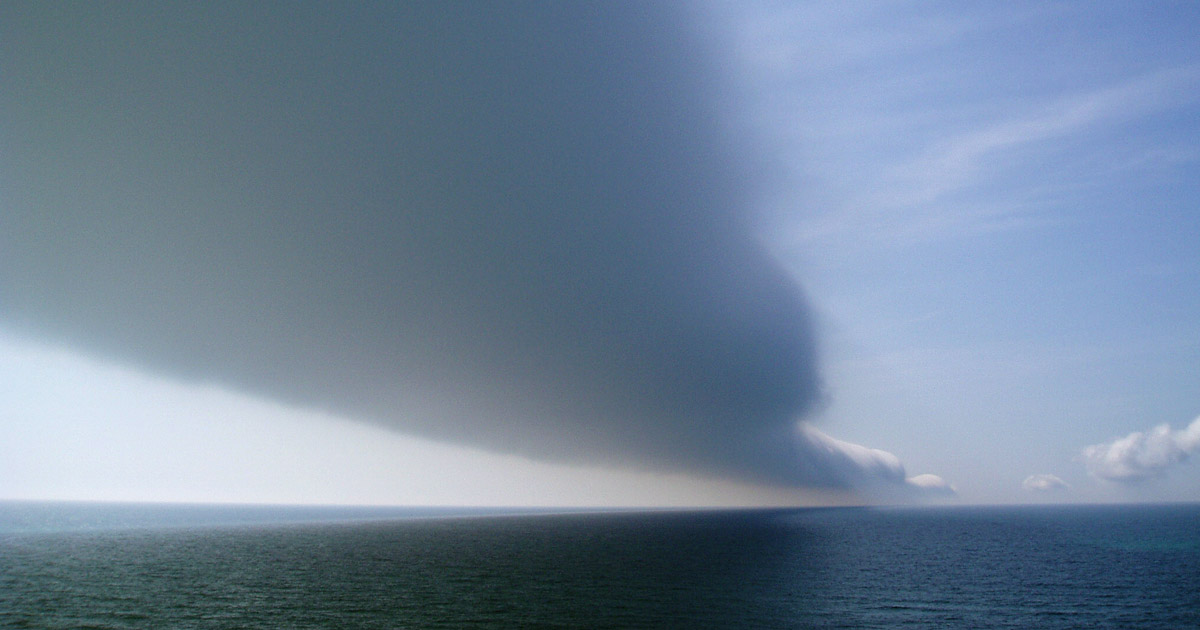
 11. A view to the northeast—the cloud reaches toward the horizon.
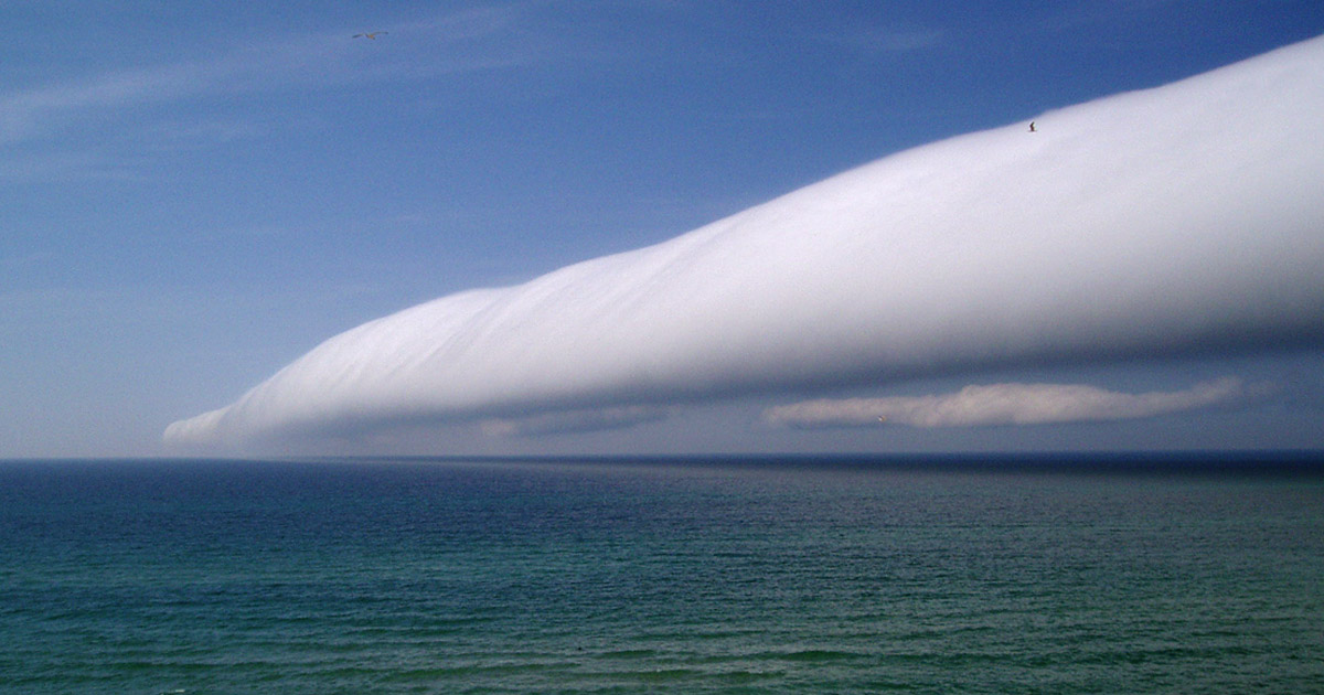 12. As the speeding cloud nears the observation site on the high dune, the parallel line of scattered cumulus trails behind.
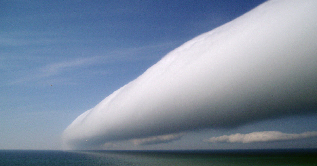 13. The cloud’s leading edge—the front (updraft) of the cloud appears smooth.
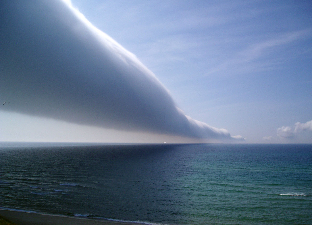
 14. This is a view to the northwest, looking along the underside of the cloud as it passes over the observation site, the brilliant white of the leading edge reflecting brightly ahead of the dense shadow.
 15. The roll cloud is passing, with a smooth leading edge and slightly irregular trailing edge.
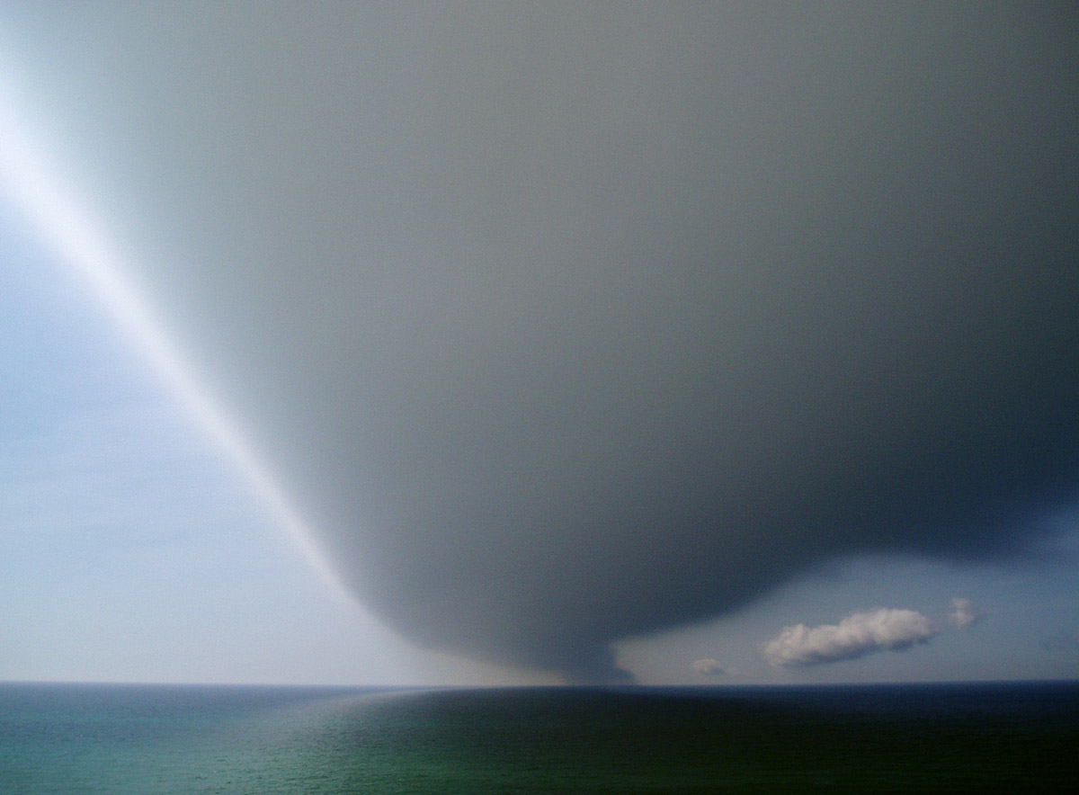
 16. The cloud casts a dark blue shadow on the ocean.
 17. Looking towards the northwest, after the cloud passed overhead. The front of the cloud was smooth, but the back (downdraft) is somewhat turbulent.
Photos 18 to 22 show views of the roll cloud over the ocean along the south side of Sable Island.
 18. A view to the southeast. The cloud, moving rapidly over the vegetated terrain, extends across the south beach towards the southern horizon. This area of the roll cloud appears to have several trailing lines of cumulus.
 19. Three minutes later, the cloud has almost reached the observation site. Along its southern end, the first trailing line of cumulus looks almost as if it might form itself into a roll cloud, and there’s a similar line beyond that. Perhaps these lines were remnants of roll clouds that had weakened and were breaking up.
 20. A view towards the southeast. With the cloud overhead and extending to the horizon, the dunes and beach are in shadow.
 21. A view towards the southeast. The roll cloud passes rapidly, and the dunes and beach are soon again in sunlight.
 22. The roll cloud has passed overhead and the trailing line of cumulus is approaching, but still far off.
The cloud continued in a southwestwardly direction. As it passed over the Sable Island Station, MSC’s instrumentation detected a sudden, brief shift in wind speed and direction, a sharp rise in barometric pressure, and drop in temperature. And then the cloud was away, out over the ocean and out-of-sight.
For more information see Roll Clouds of Sable Island.
Zoe Lucas
Sable Island Institute, July 2019